|
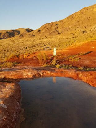
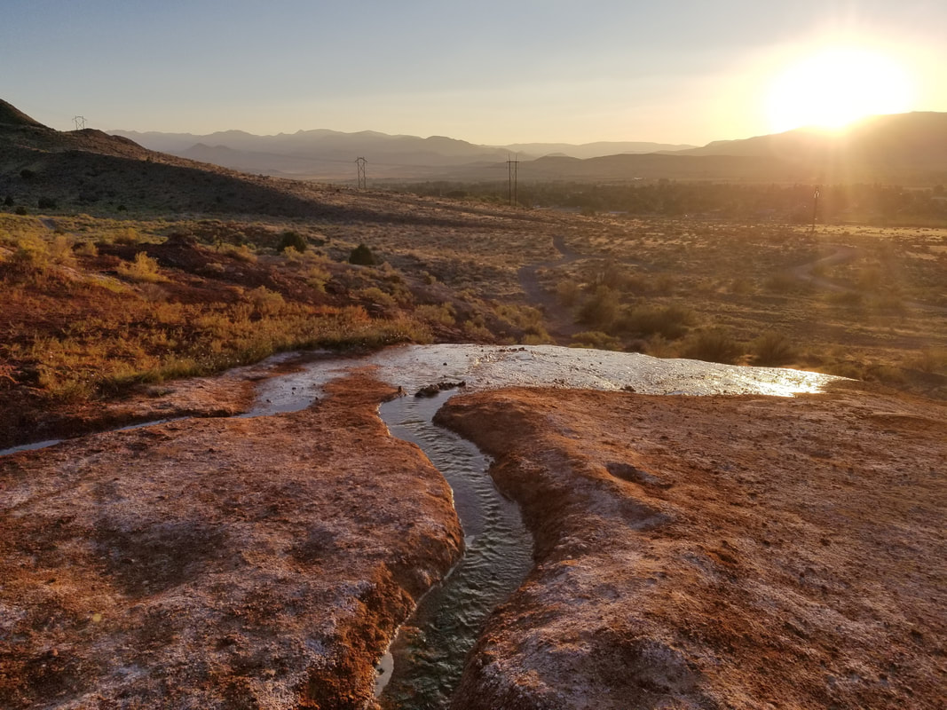
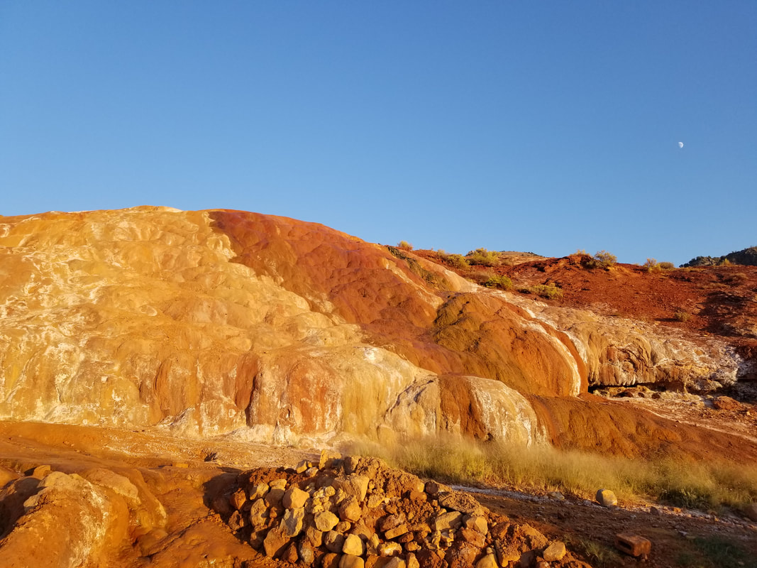
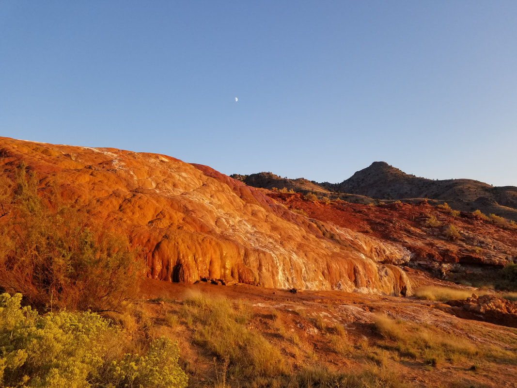
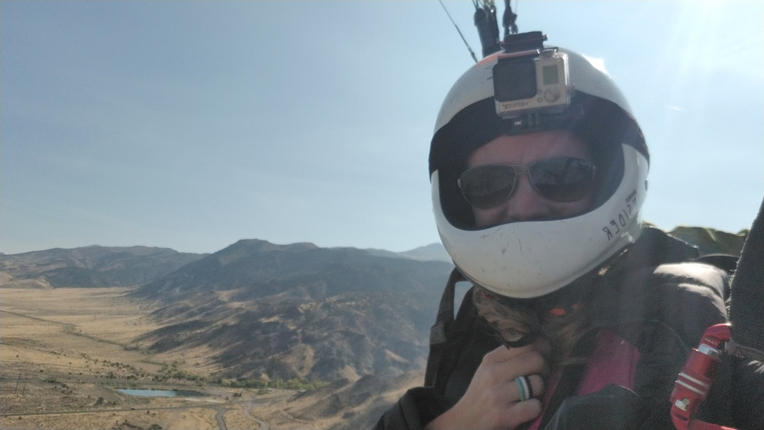
Who needs an engine or an airstrip when you have mountains, a lifting force, and empty fields? That’s what paragliding and hang gliding are all about. And you can fit the paragliding gear in (or outside, as in the picture below) the recreational vehicle of your choice! What a deal! 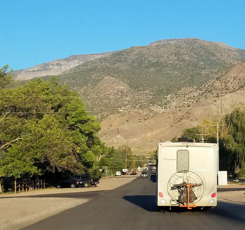 Jared and I were on the last leg of our summer “workcation.” We needed an overnight somewhere between Salt Lake City and Torrey, UT. Richfield looked like a good place, but we never thought it would be as awesome as it turned out to be. After parking the motorhome at a local campground, we took the Jeep to explore the area. We found Red Hill Hot Springs on the side of a mountain for some good sunset views and relaxation. To our surprise, a few paragliding pilots in their camper vans had the same thought. We all ended up talking camping and flying while enjoying the warmth of the natural hot springs. We had a very enjoyable evening.
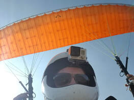
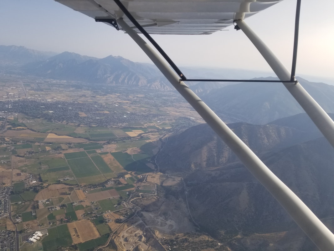
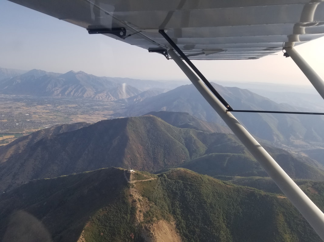
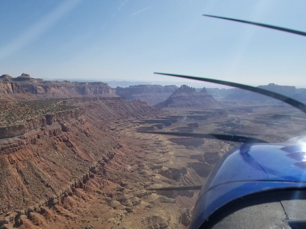
  Turned out, the mountains around Monroe and Richfield have a lot of flying potential. The pilots were there for the Red Rocks Fall Fly-in, an annual paragliding meet-up at the Monroe Rodeo Ground Landing Zone (LZ). They offered us a ride in the morning and, of course, I could not pass it up. So, the next morning, several of us drove up to Cove Launch, about 12 miles southeast of Richfield, at the top of the Thompson Basin road. The launch spot is a favorite for both seasoned pilots and students. It offers a vertical drop of over 3,000 feet to the LZ. A ridge finger extends miles out above Sevier Valley, creating soarable takeoff conditions in three different directions. I was told some pilots manage to fly for hours and up to 10,000 feet from Cove. 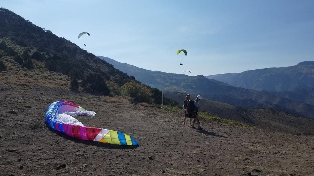 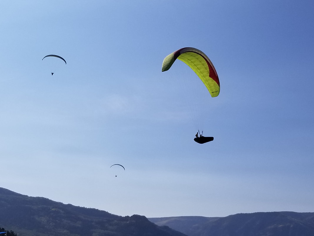 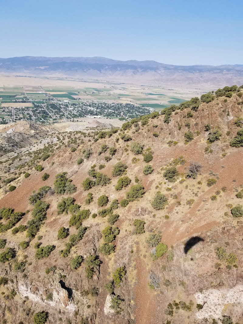
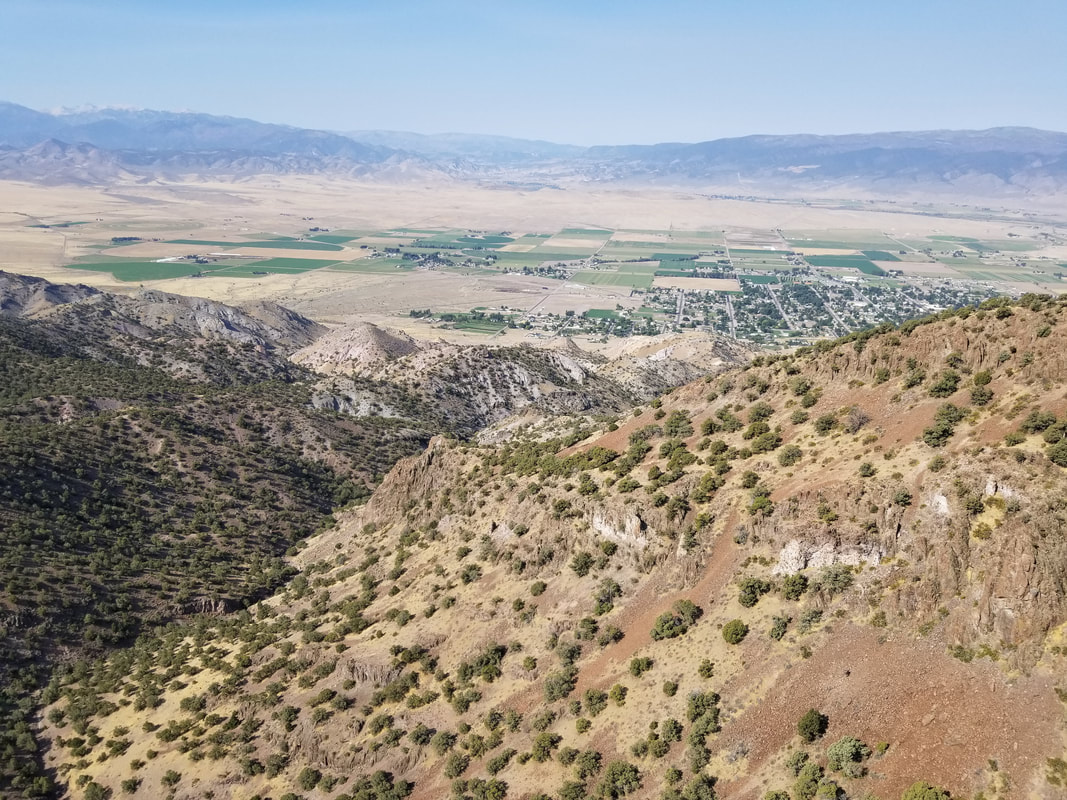 It was great fun! The wind conditions were not ideal to gain or sustain altitude, but we still enjoyed a few minutes of free flight. The LZ is shown by a pink box in the picture below. 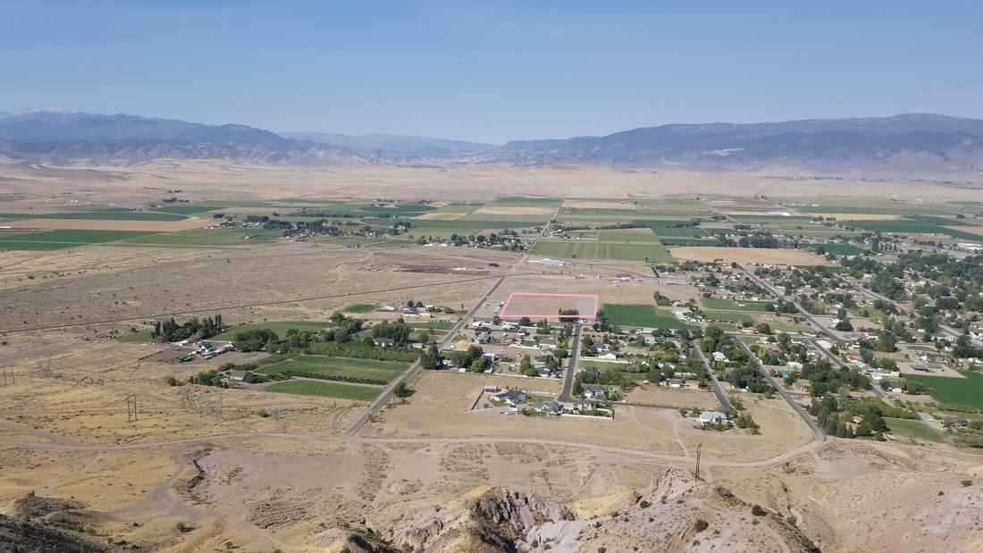 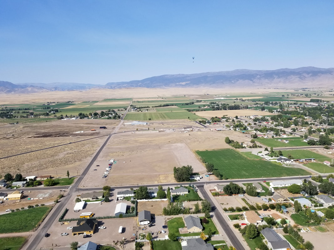 One of these days, when we stay still in an area, we need to invest in a paraglider (ideally a tandem and maybe a powered one to offer us more options) and take some lessons. This stop served as confirmation that it would be great to have a flying vehicle in the motorhome so that we don’t always have to rely on rental aircraft while we travel.
A couple of our other blogs also mention paragliding in different parts of the world: Point of the Mountain between SLC and Provo and Miraflores in Lima, Perú. (Note that Richfield is also known for having access to the Paiute ATV/Jeep Trail, a loop with no beginning and no end, passing through several towns and with side trails leading to others) Fly safe and fly often… no matter how you get up there!
0 Comments
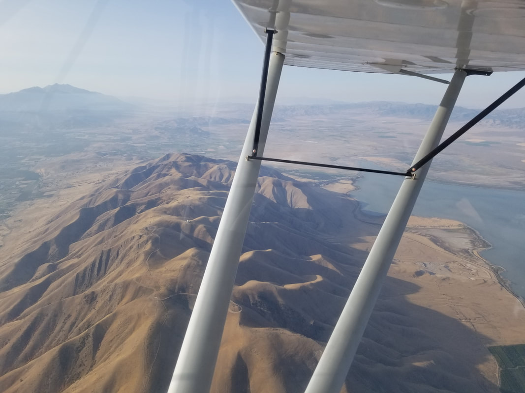
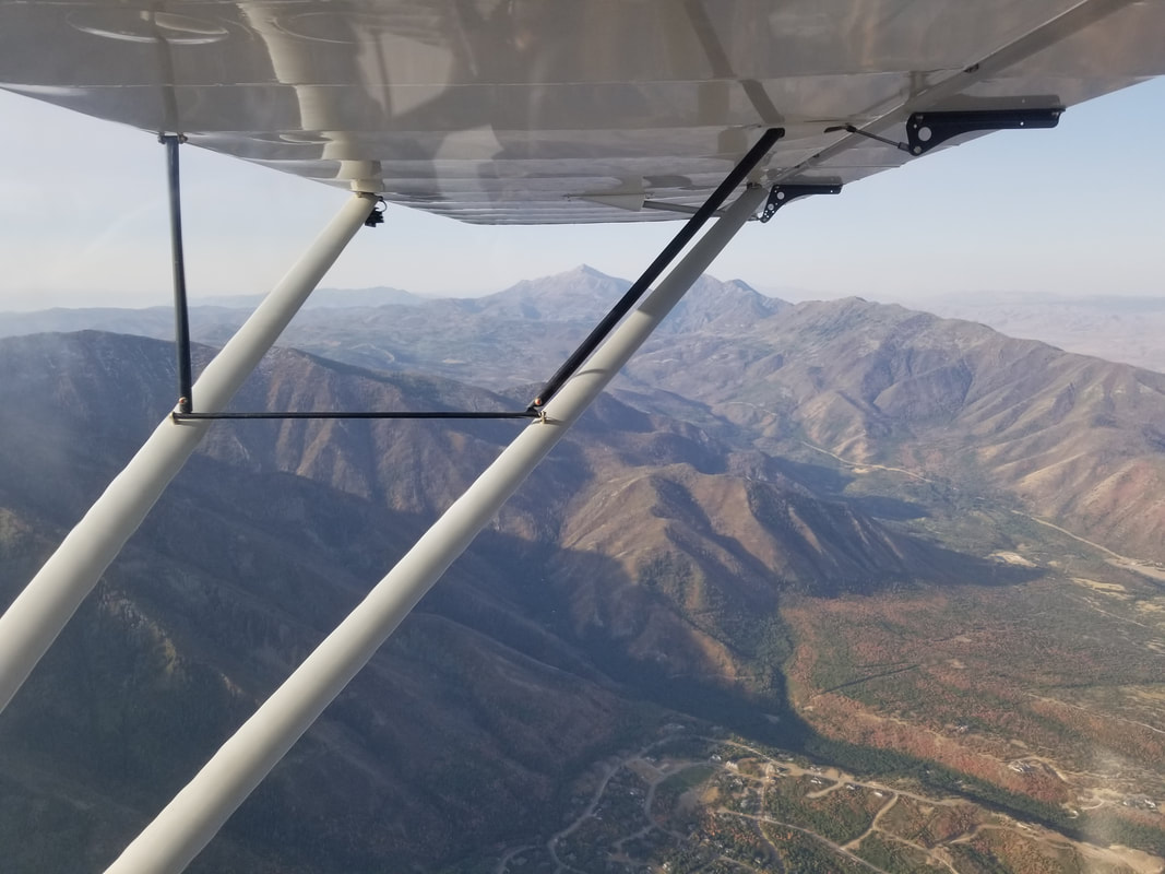
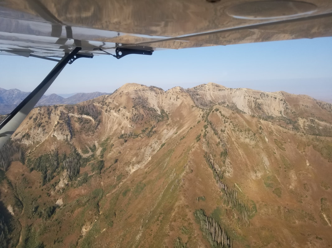
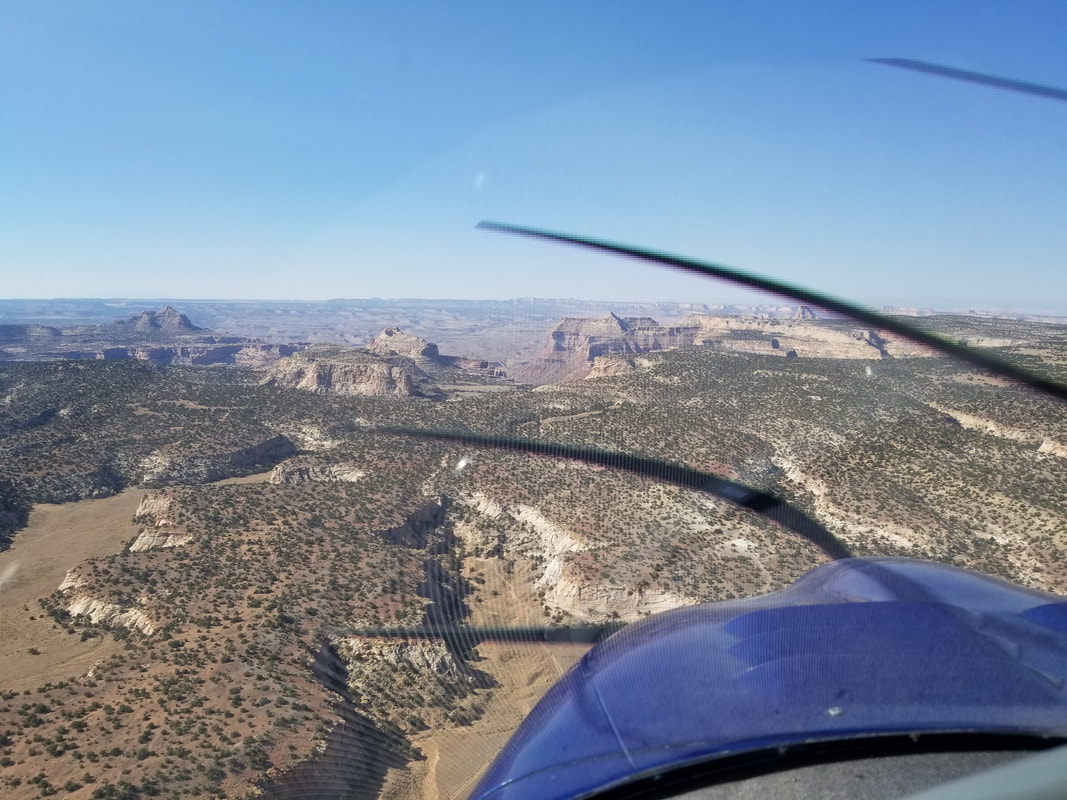
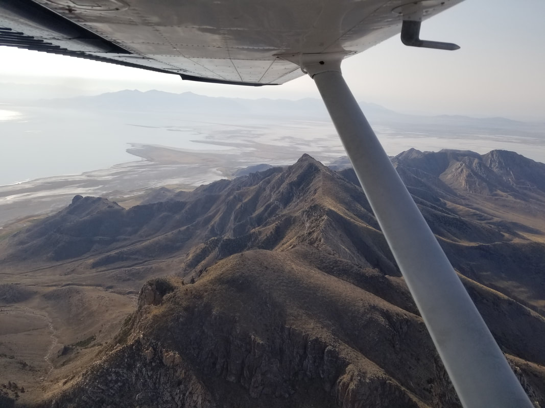
It’s a great day any time I can be in the mountains. It’s a great day when I fly. It’s a fantastic day any time I can combine the two. And, it’s the absolute best when I can combine the two, plus camp! Let me tell you about a fantastic day I had in the Utah backcountry. As you may remember from previous posts, it’s often hard to find flight schools that allow you to take their aircraft to unpaved airstrips. I have a solution for you. Give the West Desert Aviators a call next time you’re in the area: https://www.wdaviators.com/. My partners in crime were Matthew Kalm and a Rans Coyote S-6S although Mark and Alina Pringle also came along in their own Rans. Utah has over 75 backcountry airstrips. Yes, you read right! It’s not a typo! So, on this trip, we just barely touched the surface of what’s available in the Beehive State. “Elsewhere the sky is the roof of the world; but here the earth was the floor of the sky” – Willa Cather. The route was West Desert Airpark (UT9)-Cedar Mountain-Mexican Mountain-UT9. Neither of the backcountry airstrips have FAA identifiers and the best information (including recent condition reports although keep in mind these, like some PIREPs, are somewhat subjective) about them can be found on the Utah Back Country Pilots Association (UBCP) website: https://utahbackcountrypilots.org/. UBCP also organizes work parties and fly-outs to UT backcountry airstrips. It’s a fantastic organization. 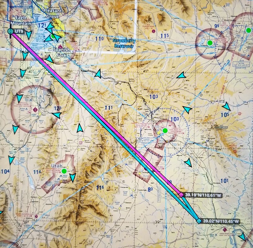 Source: ForeFlight As typical backcountry airstrips, neither of these airstrips have any services so keep that in mind when planning your route: no restrooms, no water, no weather info, no lights, no cell phone service, and no fuel! Both have windsocks though and do use them! We start heading southeast out of UT9, across Utah Lake and over the Mount Nebo Range.
We then flew over the Wasatch Plateau and Huntington before reaching Cedar Mountain.
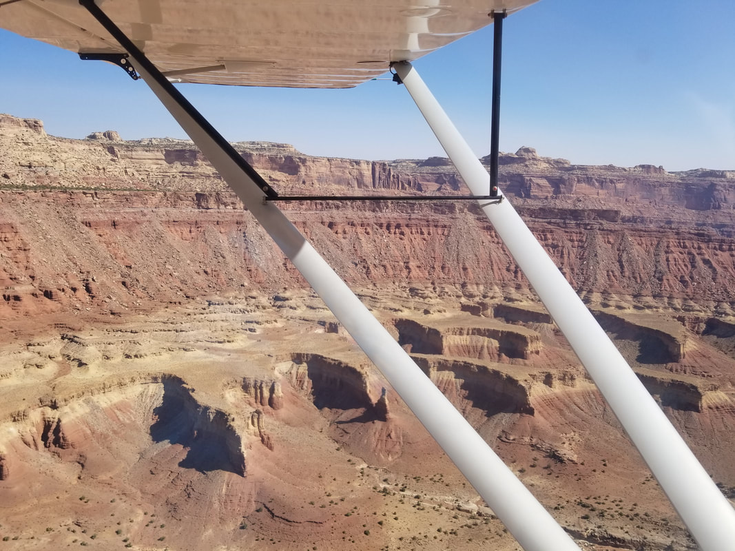
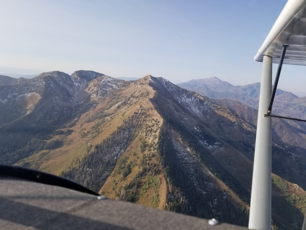
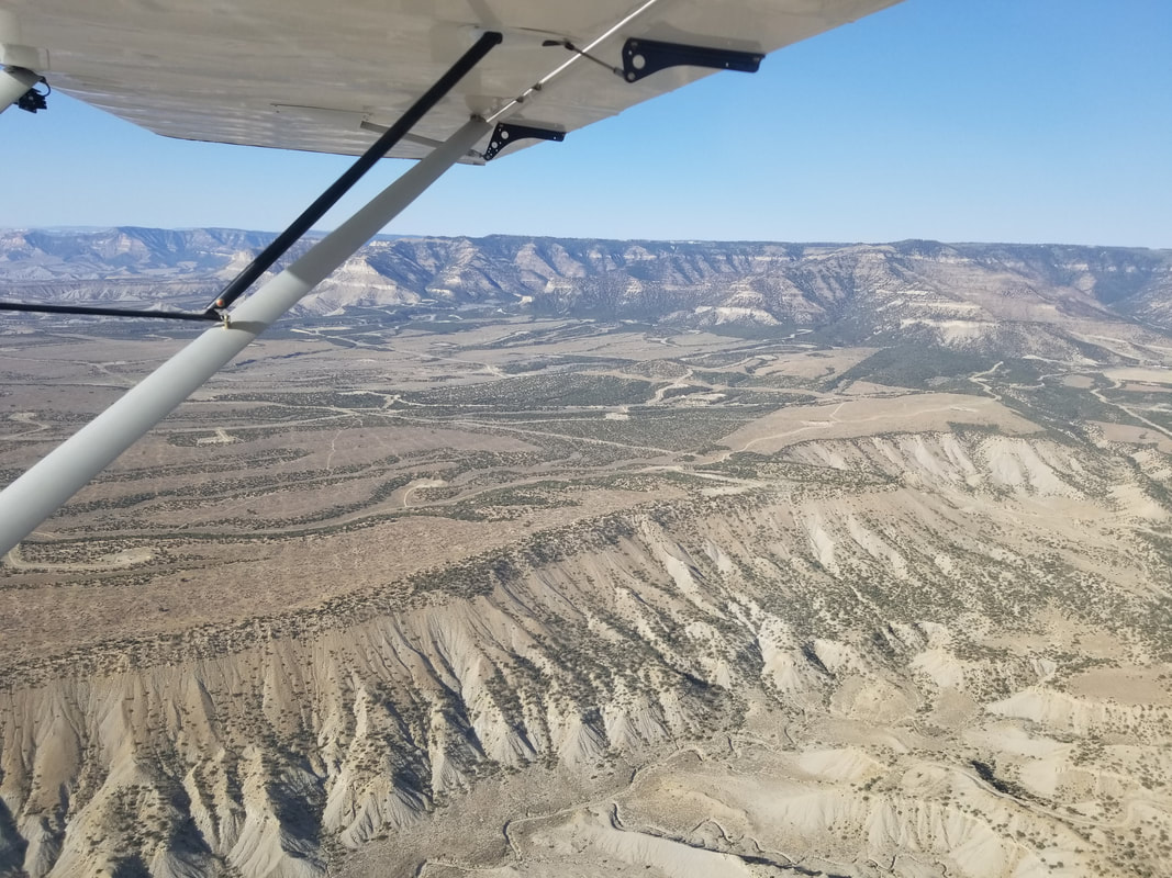
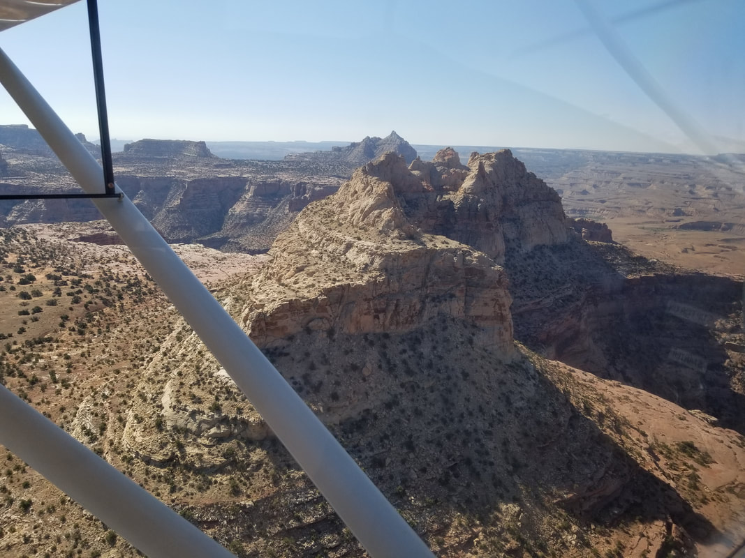
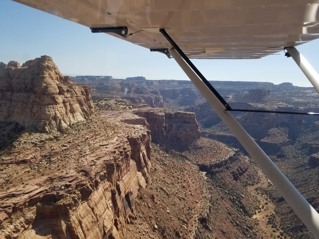
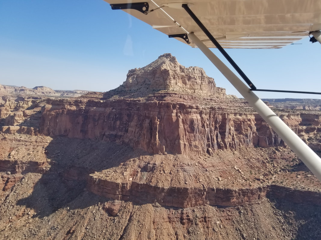
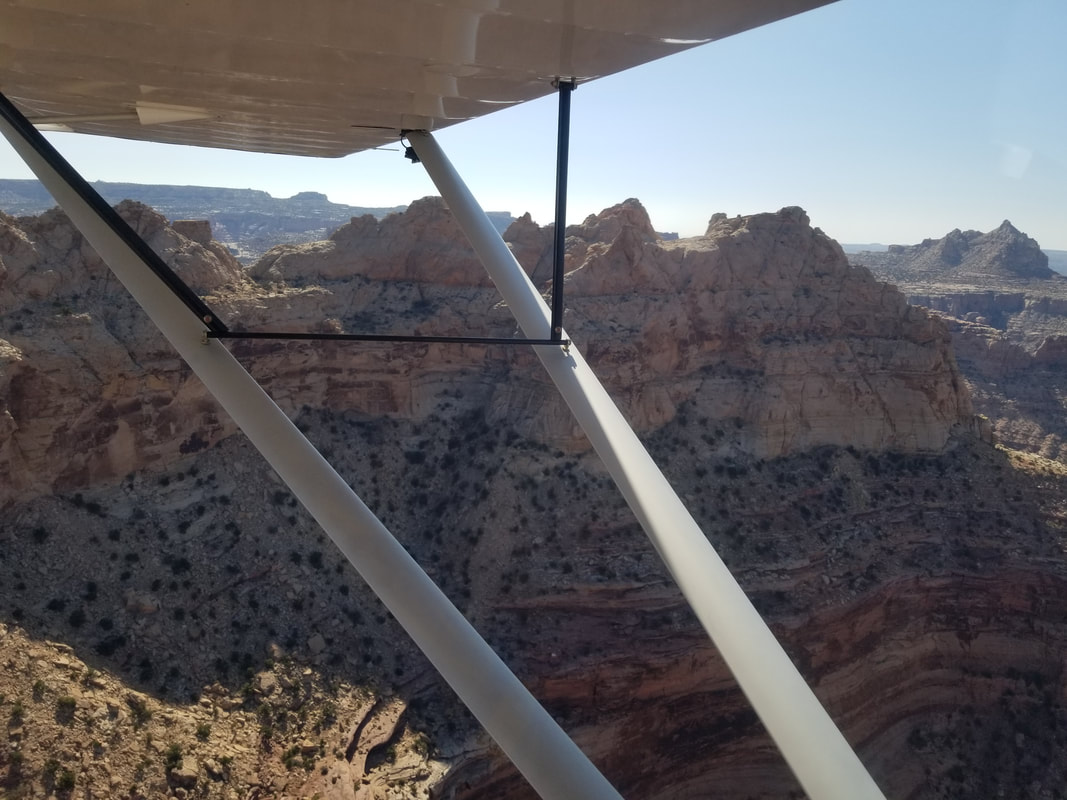
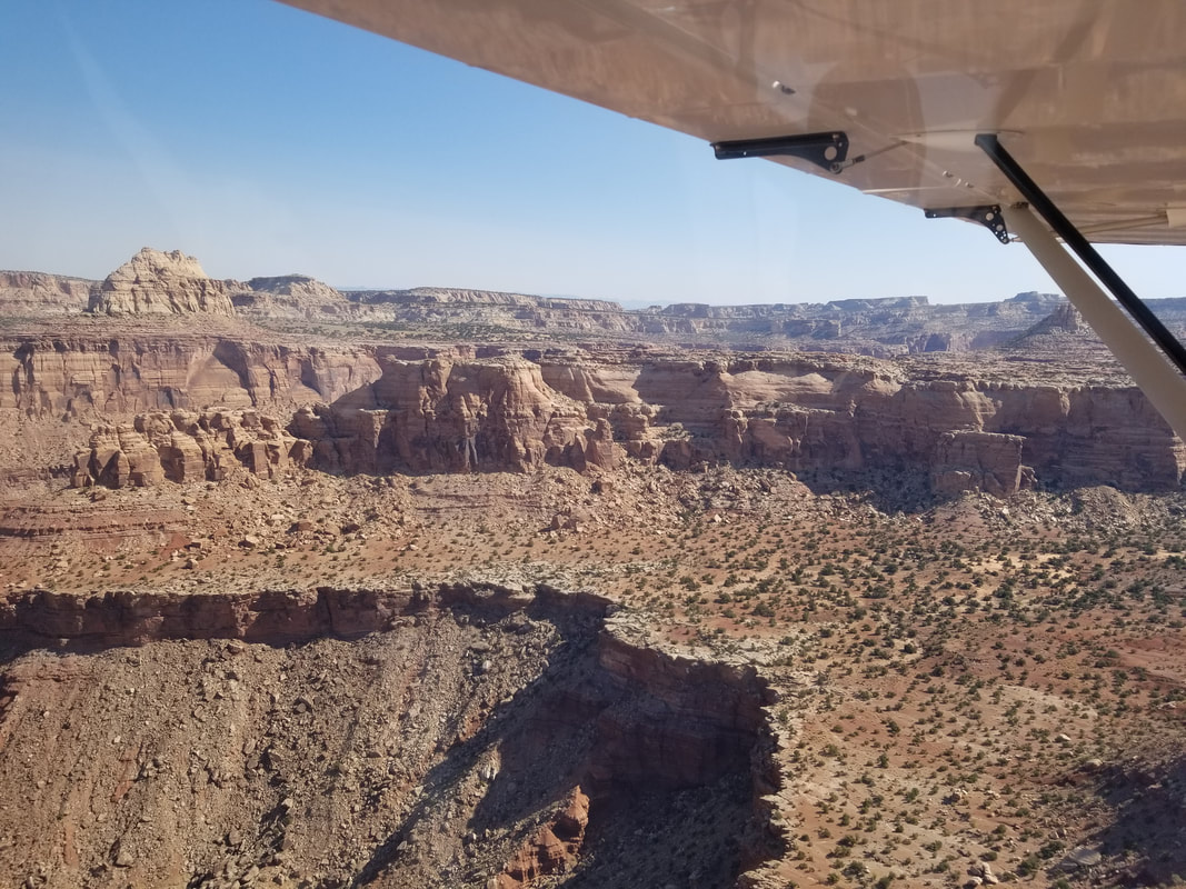
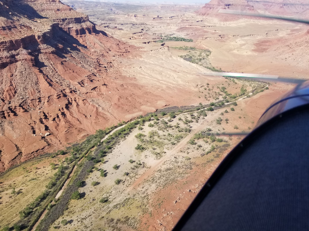
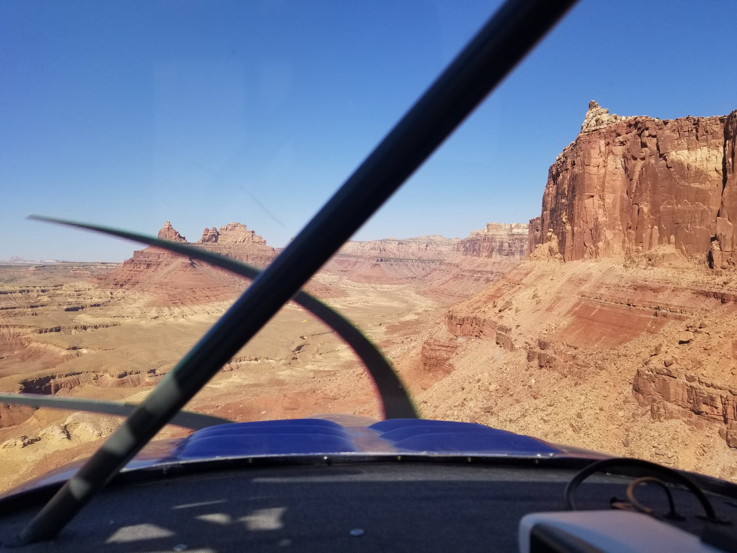
You can see in the sectional there are some significant contours, mountain elevations, and peaks along the route but nothing we couldn’t go over or around. Cedar Mountain has an elevation of 7,538 ft and its dirt runway 15/33 is 2,050 x 47 ft. Often times, leaving these airstrips is harder than coming in due to density altitude. The wind was fairly calm but a recon flight over the airfield did show the windsock favoring Runway 15. 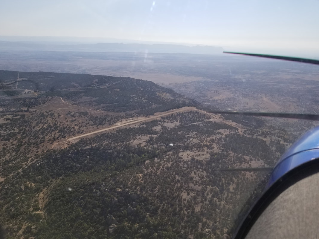 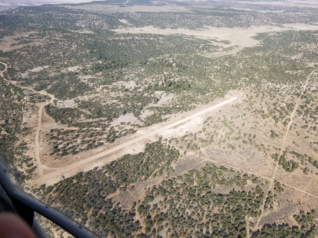 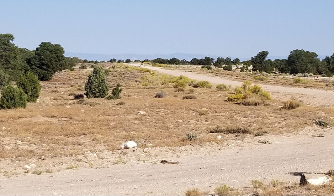 It’s important to keep in mind that Runway 15 ends with a 1,500 ft vertical drop and, I mean, it’s a sharp, shear drop. No Engineered Material Arresting System (EMAS) involved!! 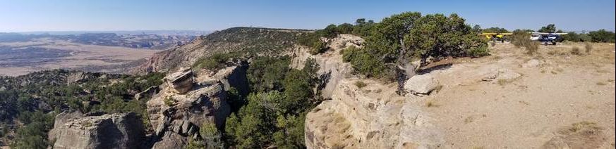 Do you see Utah's Yosemite in the distance? Here's a close up: 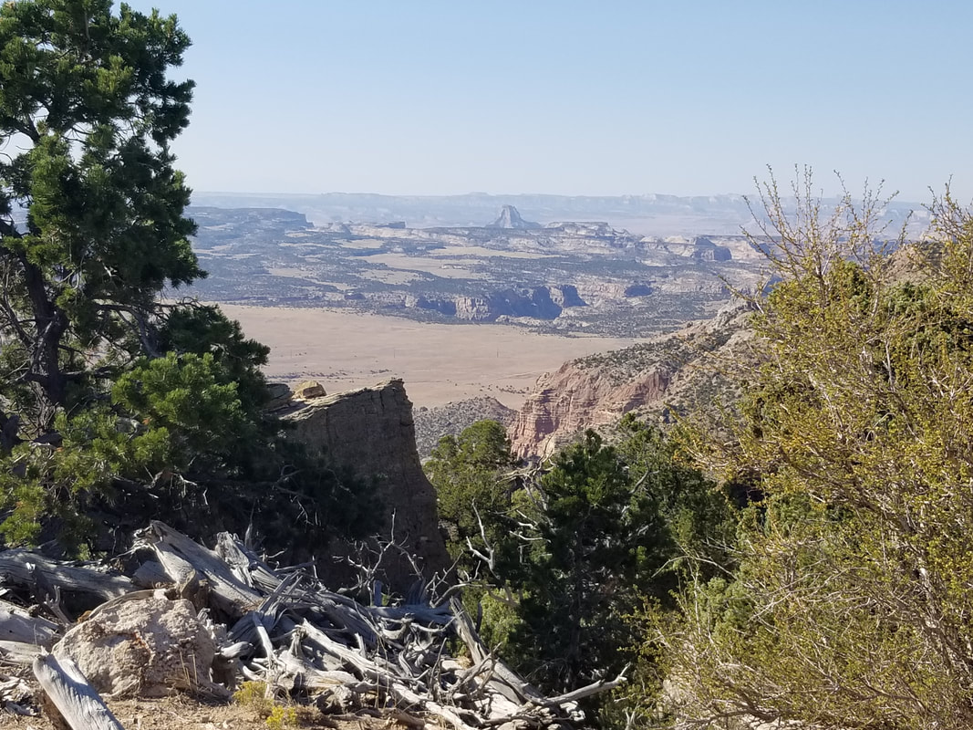 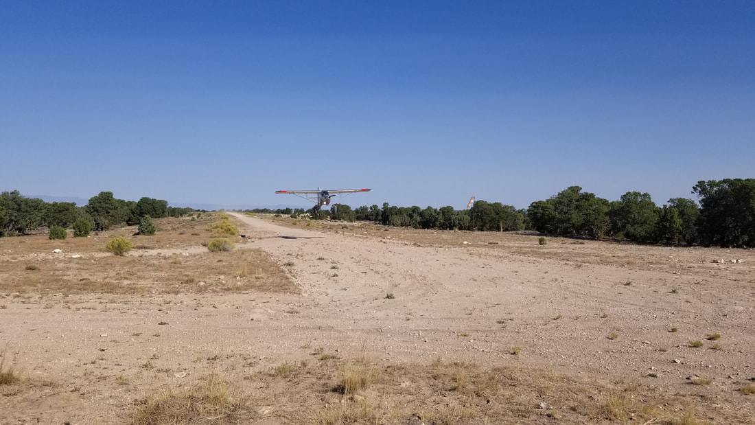 The flight from Cedar to Mexican Mountain was really pretty with red rocks, cliffs, towers, and canyons all around. It was mostly a descent, from the higher elevation Cedar to the lower elevation Mexican. 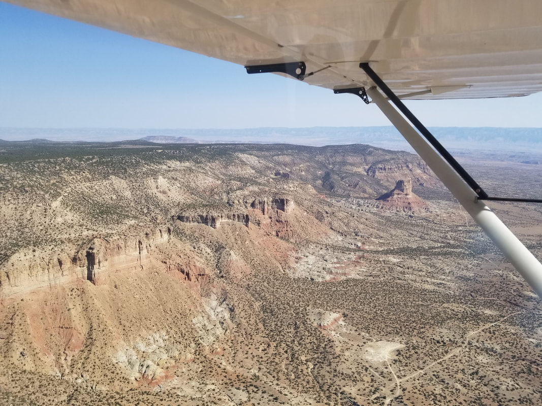
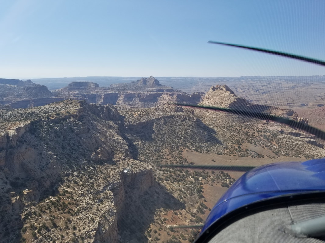
 Mexican Mountain is in sight: 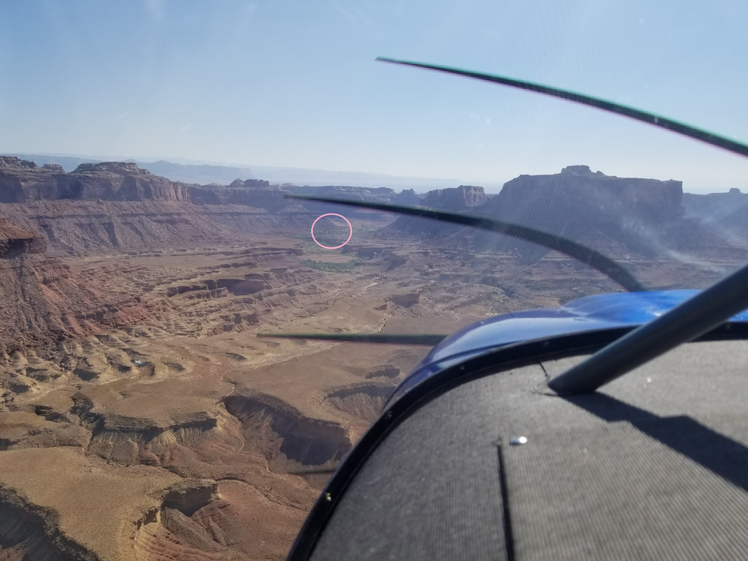  Mexican Mountain is at 4,461 ft elevation and its dirt runway 11/29 is 1,900 x 40 ft although it felt much narrower than Cedar because the sides are not as clear as Mexican’s. You can see this in the pictures provided. Winds were pretty calm but a recon flight over the field showed the windsock favoring Runway 29. So, we flew out and over the San Rafael River to make a left, 360-degree turn back. Note this turn is made inside the valley. We then flew a left downwind for Runway 29 so we could inspect, once again, the condition of the runway. However, to be able to turn base and final, one has to extend the downwind a bit to clear terrain. 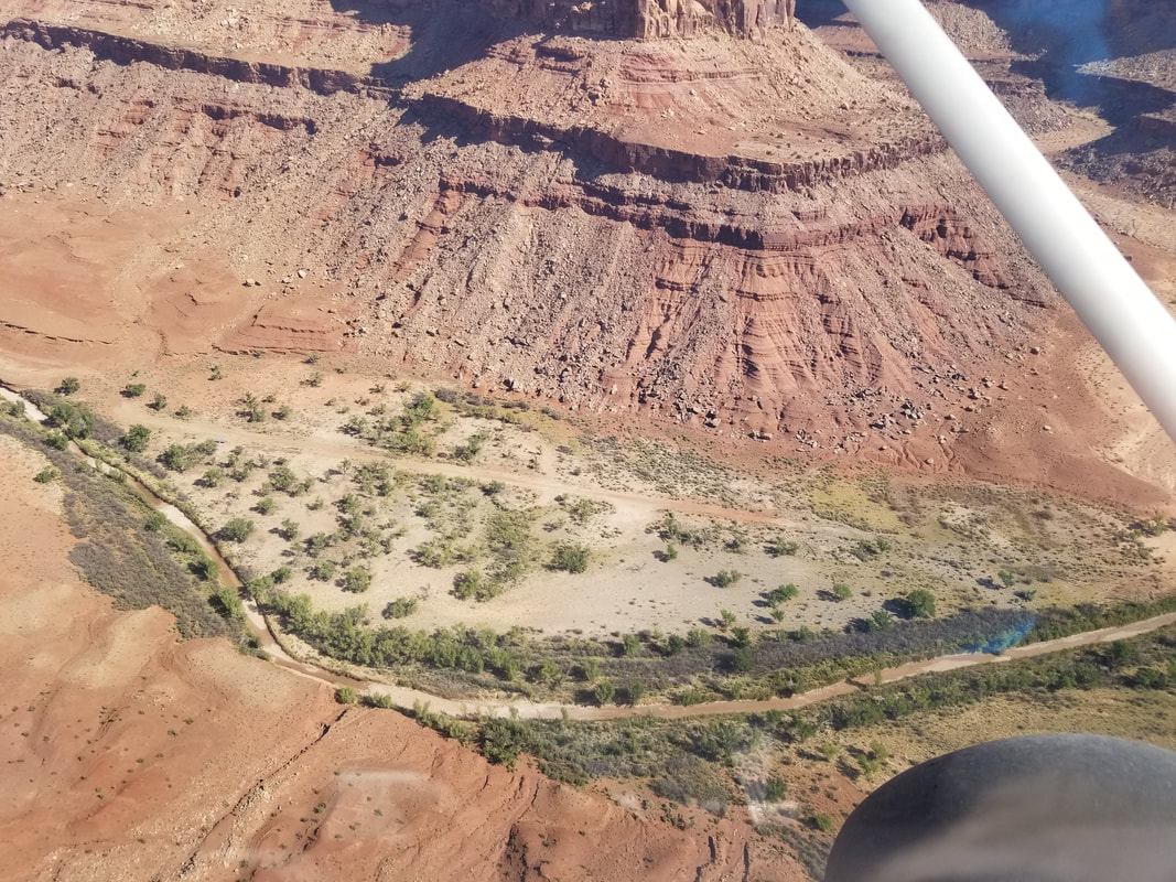 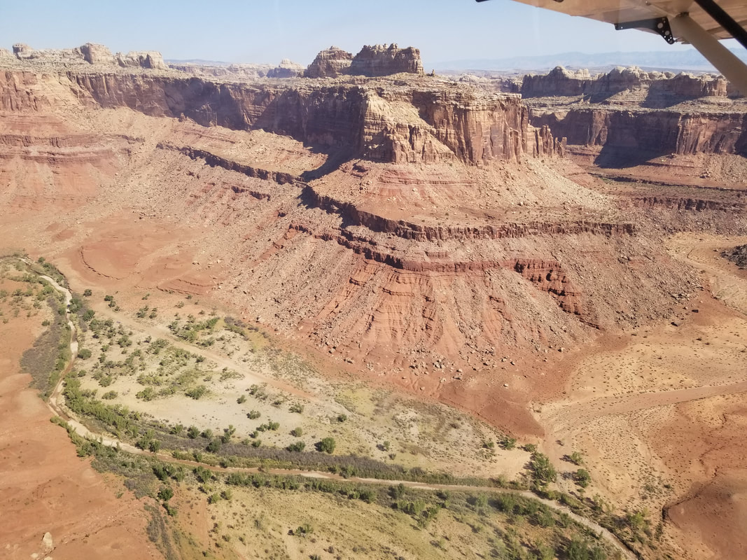
The landing was fairly sporty with trees and brush all around. 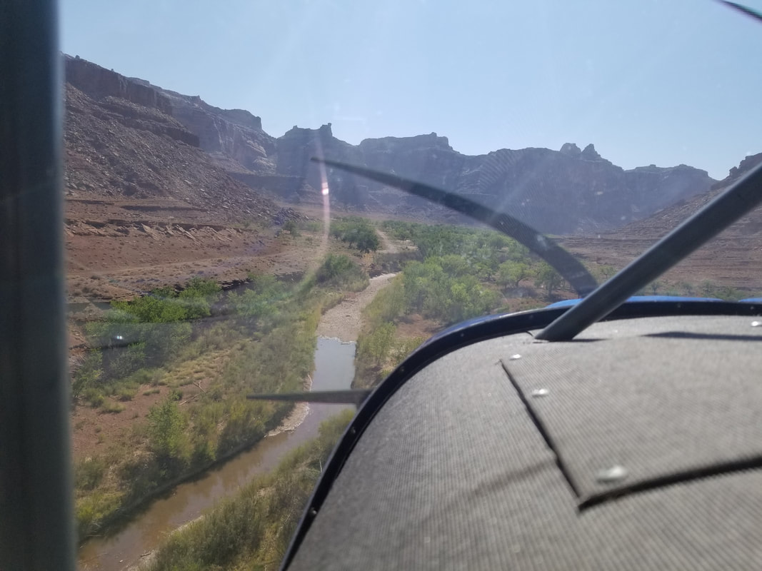 Taxiing to the parking area: 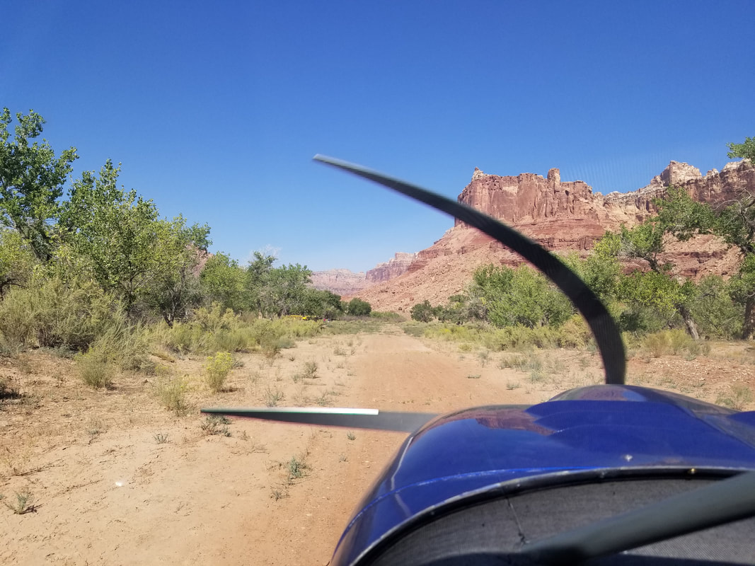 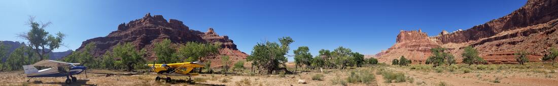 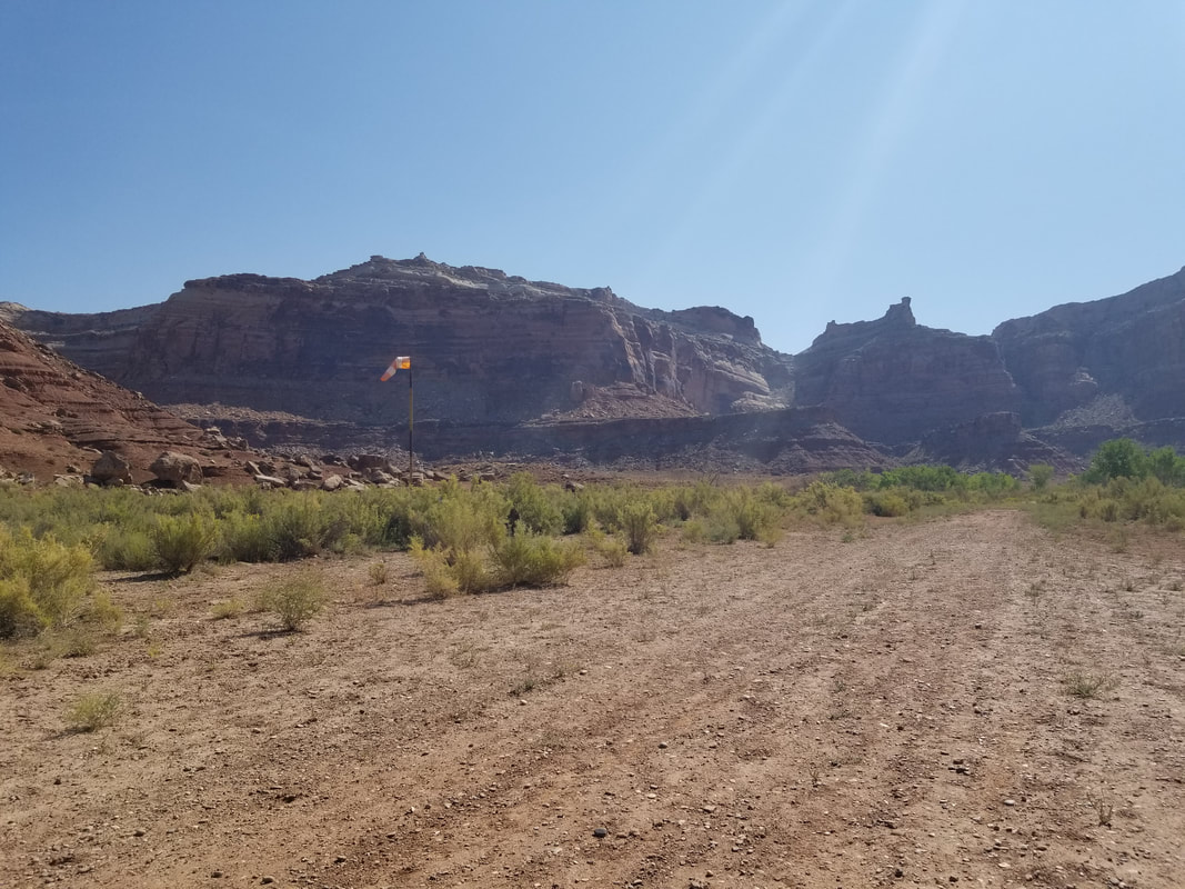 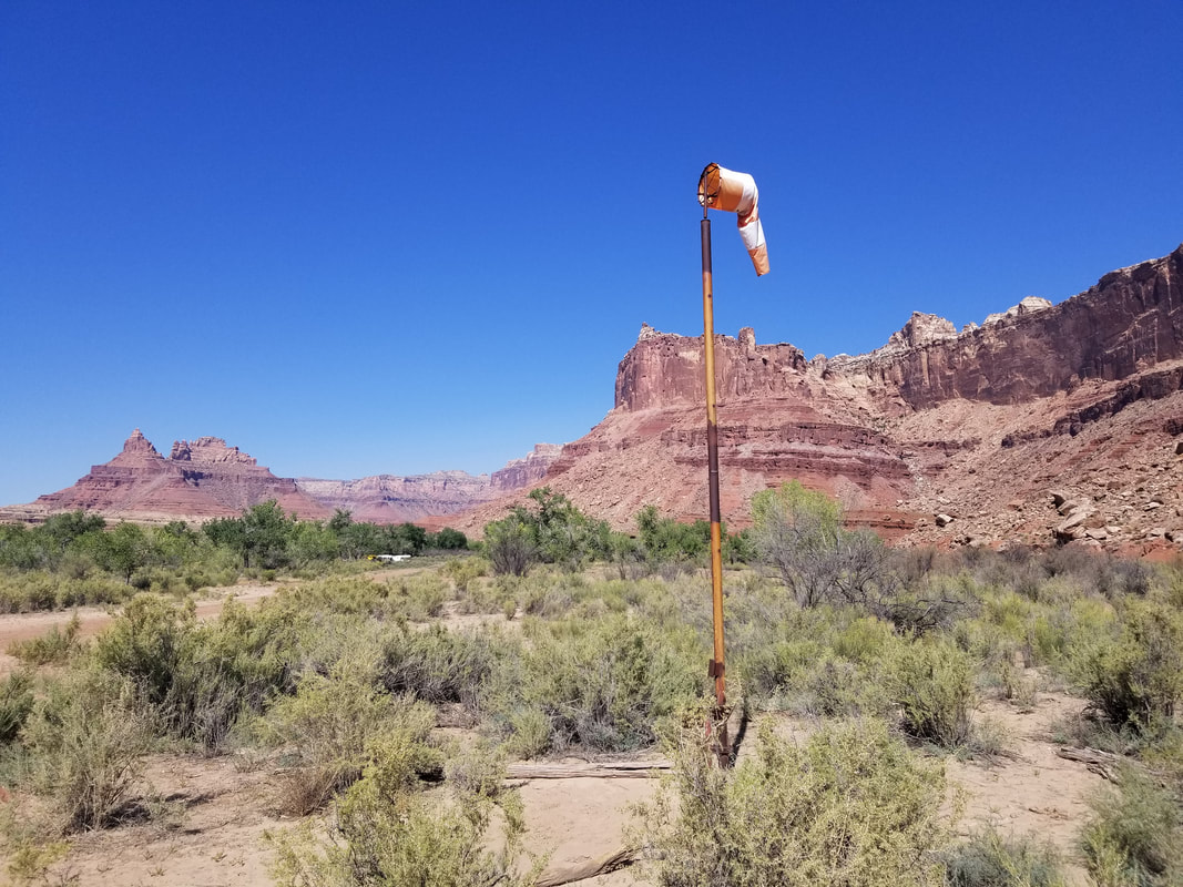 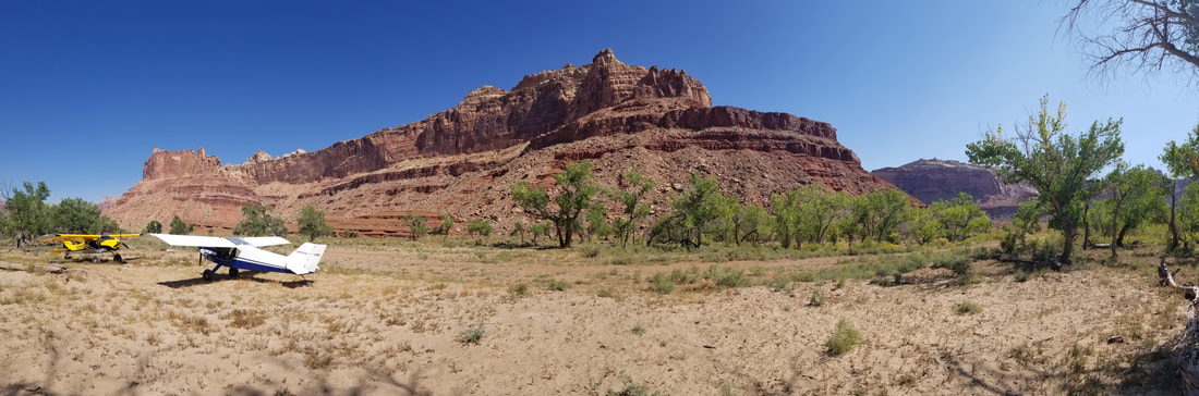 Once on the ground, we enjoyed a short walk to view several old Native American petroglyphs. And you have to wonder how many more there must be in the area… There’s a sign that tells a bit about the area’s history. 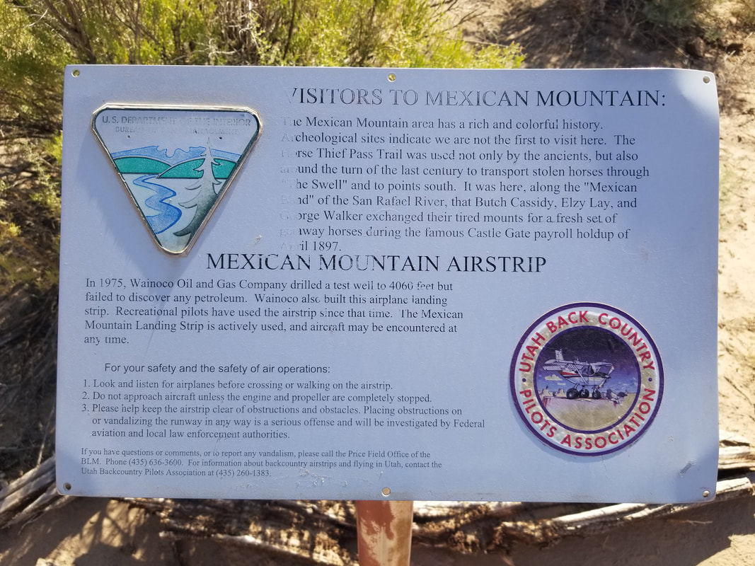 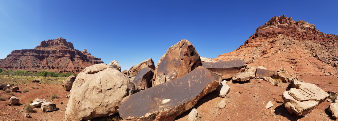 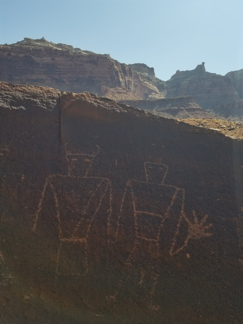 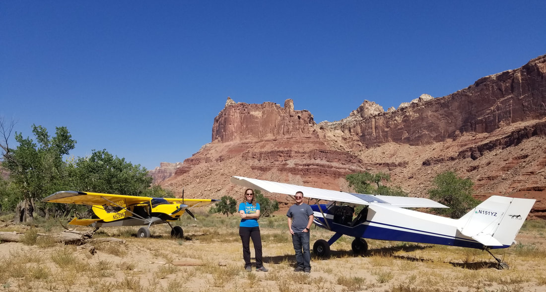 I could have spent a couple of days at Mexican Mountain. What a stunning place! But, we “beat feet” as Alina said, to remove dirt from our shoes, and we departed back to UT9 after a little while. 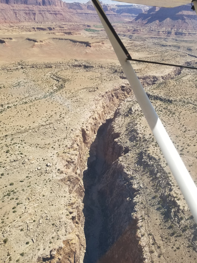 This area seriously looked like Monument Valley... 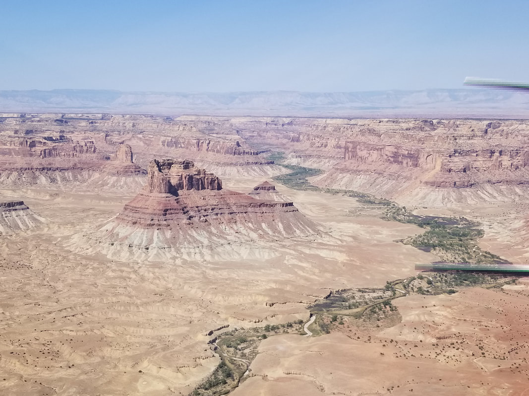 ... and Horseshoe Bend. 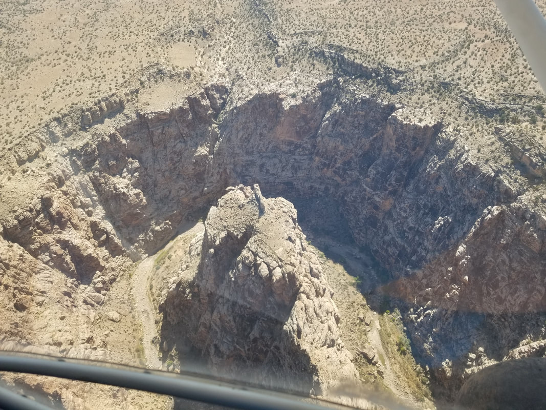 We also spotted some windows on the rock. 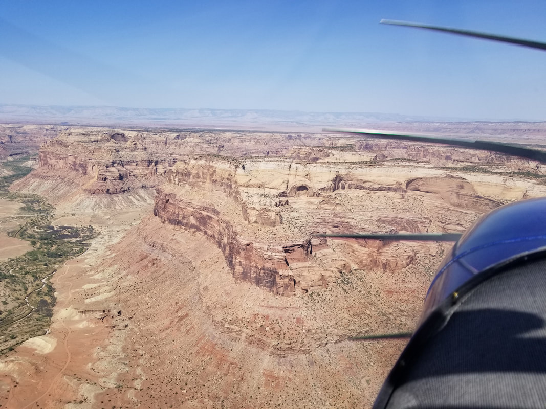 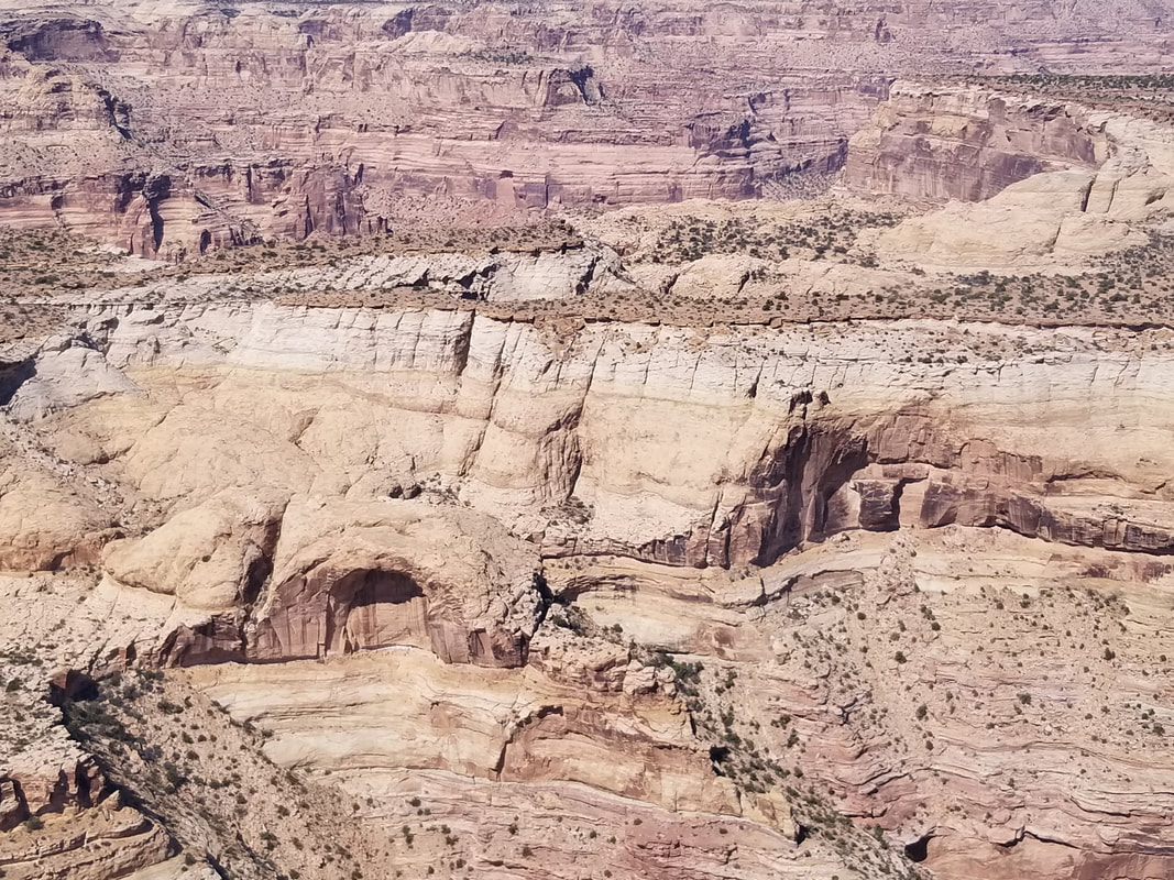 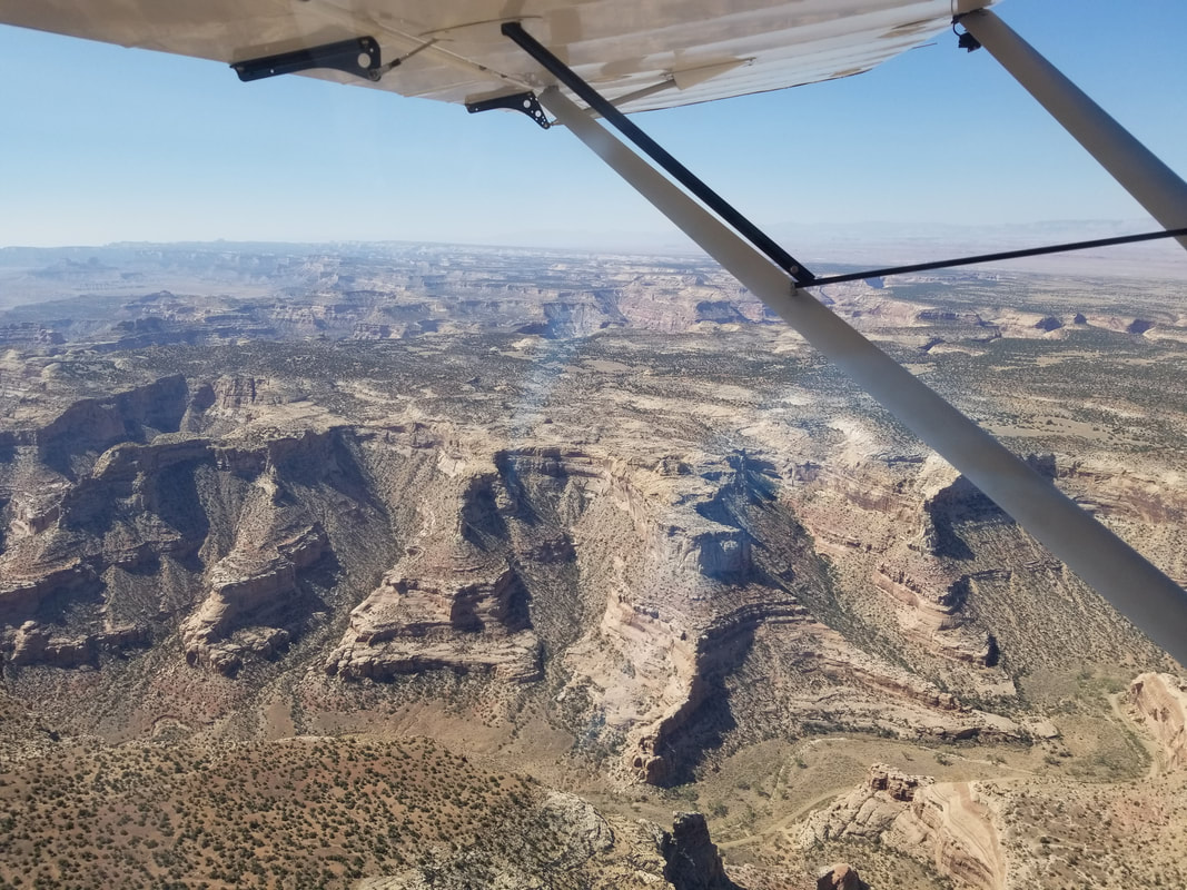 Huntington Municipal Airport (69V) in the distance and a good place for fuel although we didn't need it. 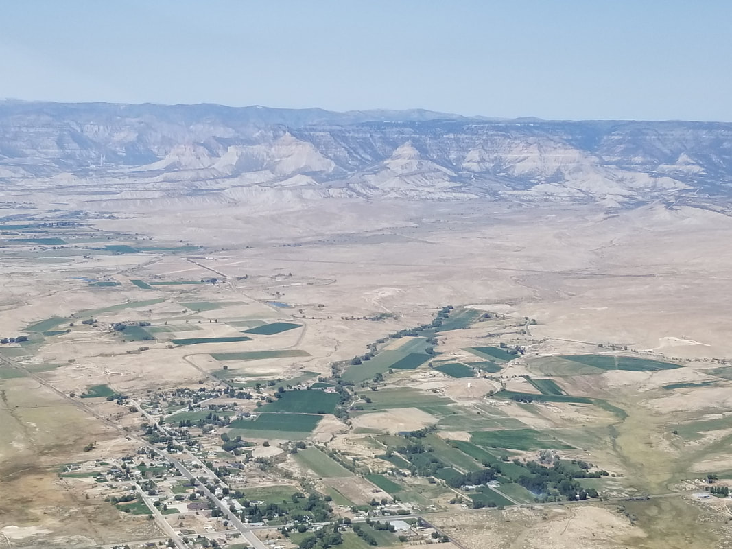 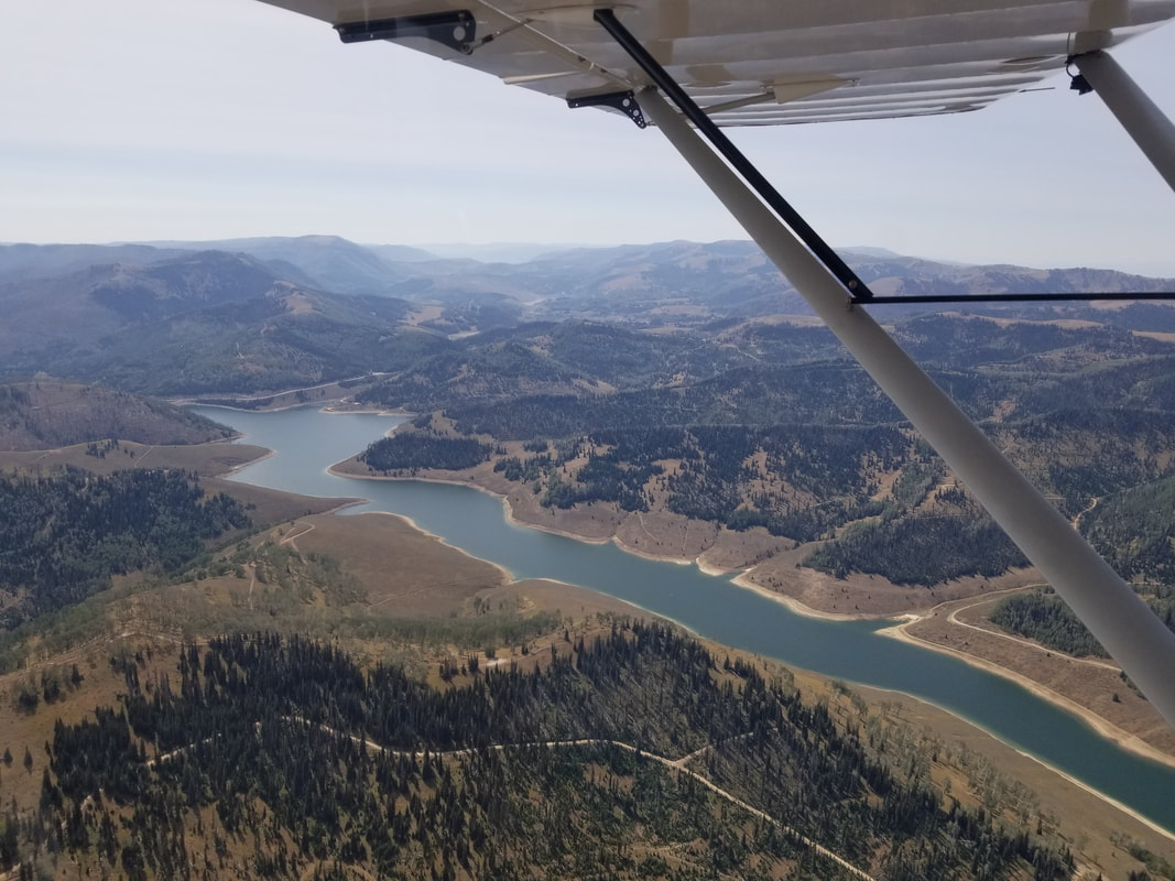 A little formation flying for the soul:
As you can see from both my description and the pictures, going to Cedar Mountain first was a good warm-up for the more challenging Mexican Mountain.
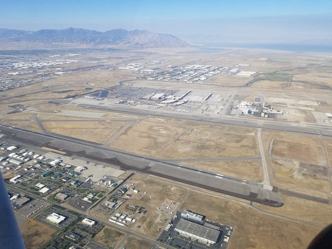
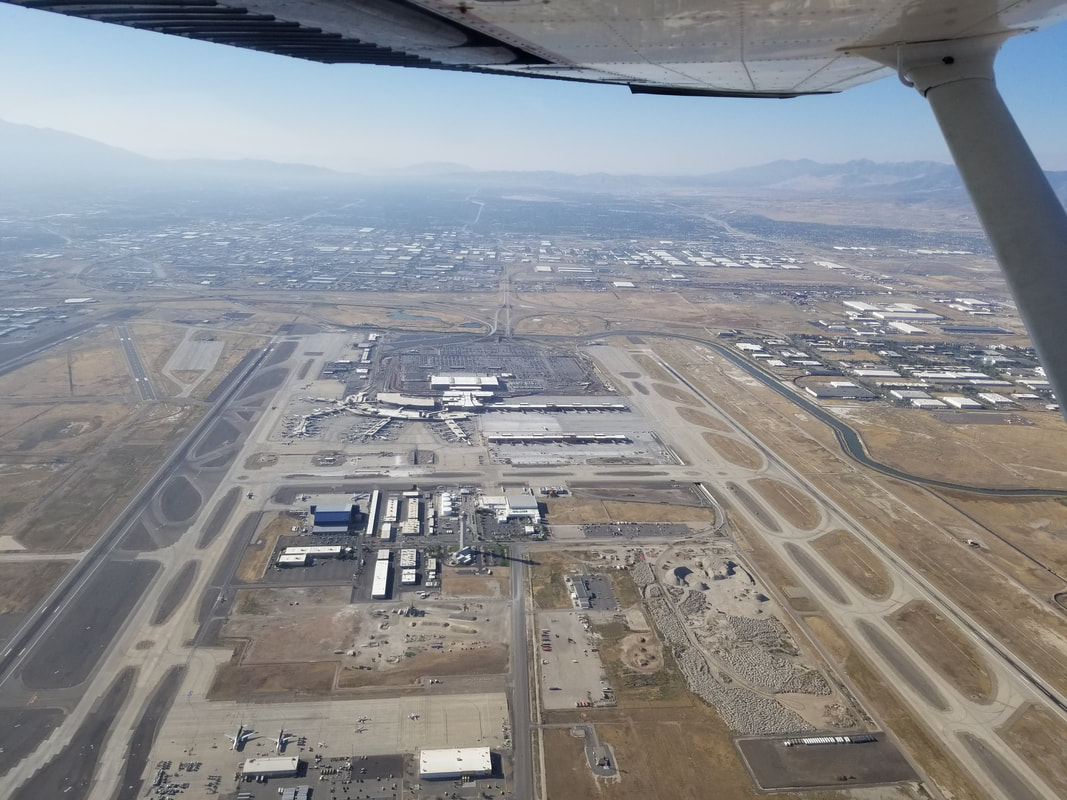
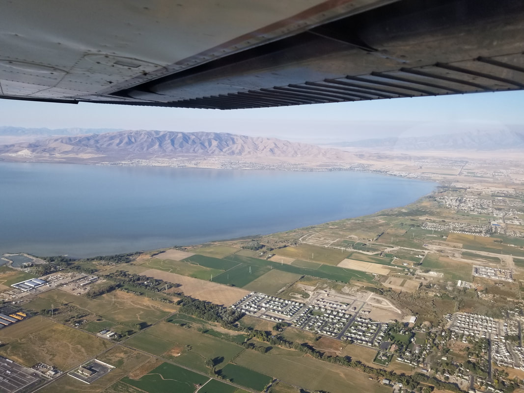
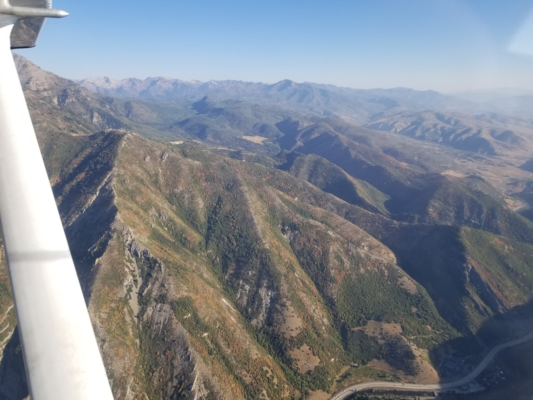
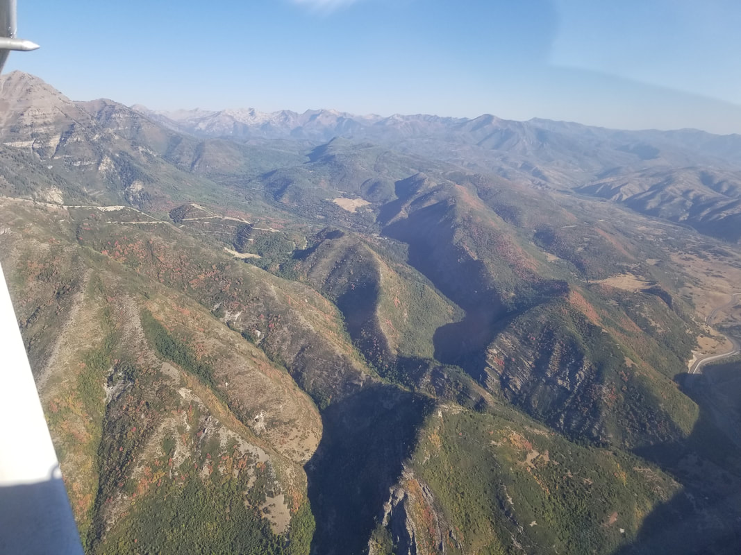
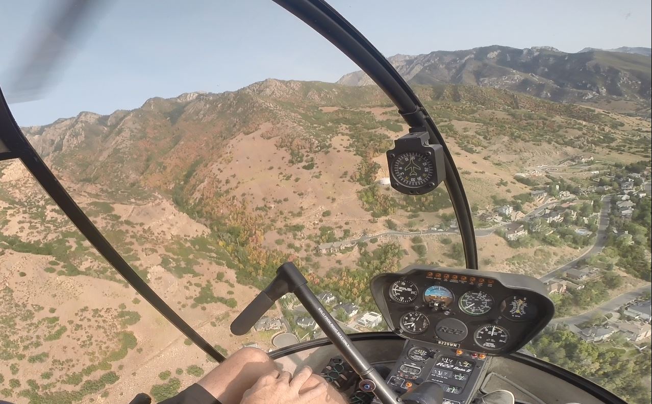
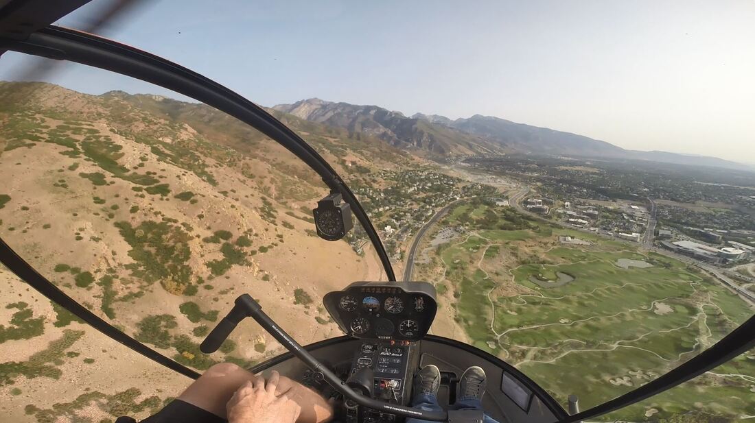
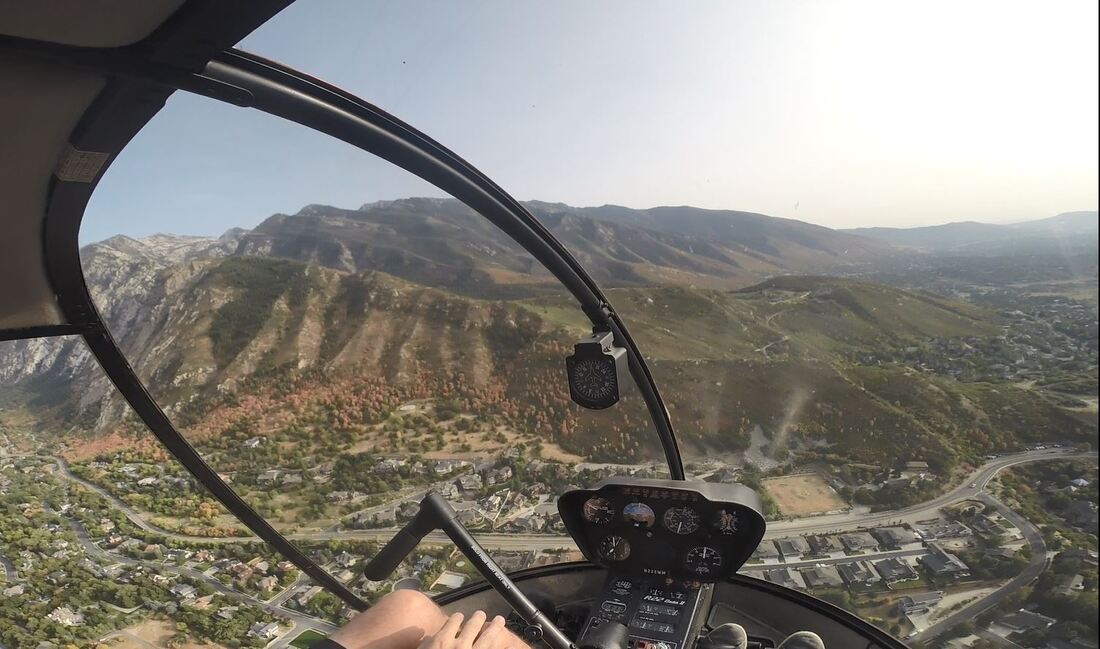
I would say that just about anybody with prior “soft” (meaning unpaved) field airfield experience can visit Cedar Mountain; however, Mexican Mountain requires backcountry/mountain experience and a capable airplane (airplanes with wheel pants, for ex, may not enjoy it too much). So, are YOU ready to fly in and “beat feet” on your way out? Or, if you can’t quite do that with your airframe, “stomp your feet together” as my niece would say, from a song she likes. Fly safe and fly often! Flying cross country? Trying to cover a bit of ground? Need to get somewhere fast? On a budget? Take the airplane. Want to go sightseeing? Low and slow desired? Doorless? And land on cool spots? Have a little extra cash to burn? Let’s take the Air Jeep; aka the helicopter. After a month in Montana and a few days in Yellowstone and Grand Teton National Parks, we spent another month in Utah this fall with the motorhome. We have gotten to know Utah pretty well over the years, but we still can’t get enough of it. Funny enough… our Utah bucket list continues to grow instead of shrink. I managed to fly four times this time around, two of which were around the Salt Lake City (SLC) area: the first time in an airplane and the second one in a helicopter because there are different aircraft for different missions. I flew with Platinum Aviation (https://platinumaviationut.com/) and their sister company Utah Helicopter (http://www.utahhelicopter.com/), respectively, out of South Valley Regional Airport (U42). Flying the airplane first gave me a great overview of SLC and its surrounding suburbs, towns and, more importantly, mountains and outdoor areas. It also allowed me to pinpoint a few areas to fly with the helicopter later: slower, lower, closer. 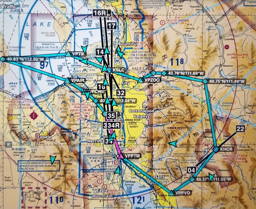 Source: ForeFlight We started out flying southeast towards the Point of the Mountain VFR checkpoint (VPPTM) but remaining west of it as hang gliders and paragliders love to fly from it. 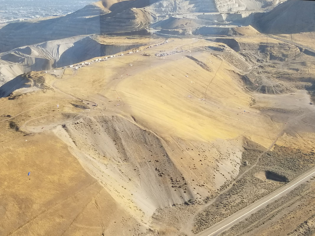 What I like most about the greater SLC area is that there are mountains both east and west of the valley (unlike in Denver, for example, where there are only mountains west of the city). However, having two significant bodies of water (Utah Lake by Provo and the Great Salt Lake in SLC) makes it easy to get your bearings correct.
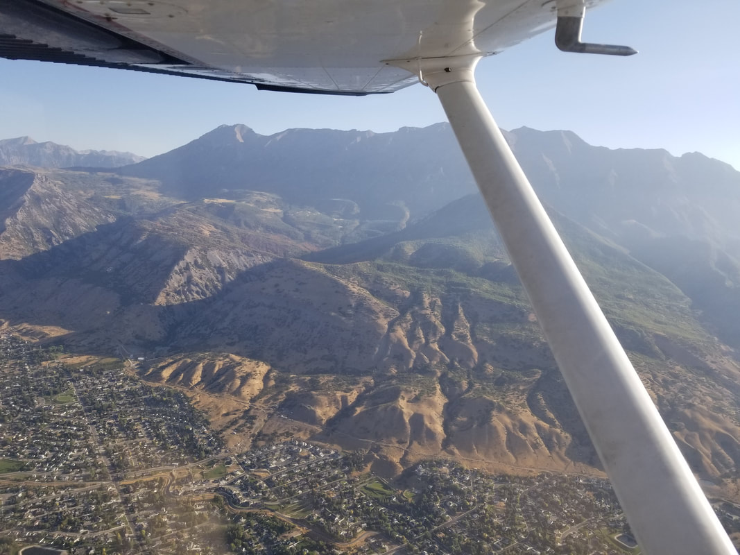
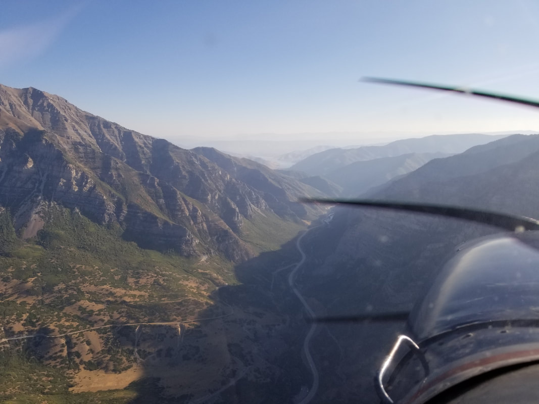
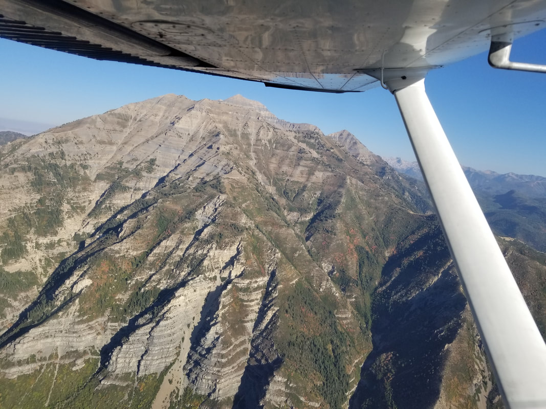
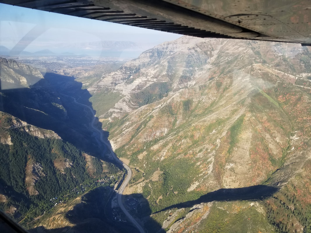
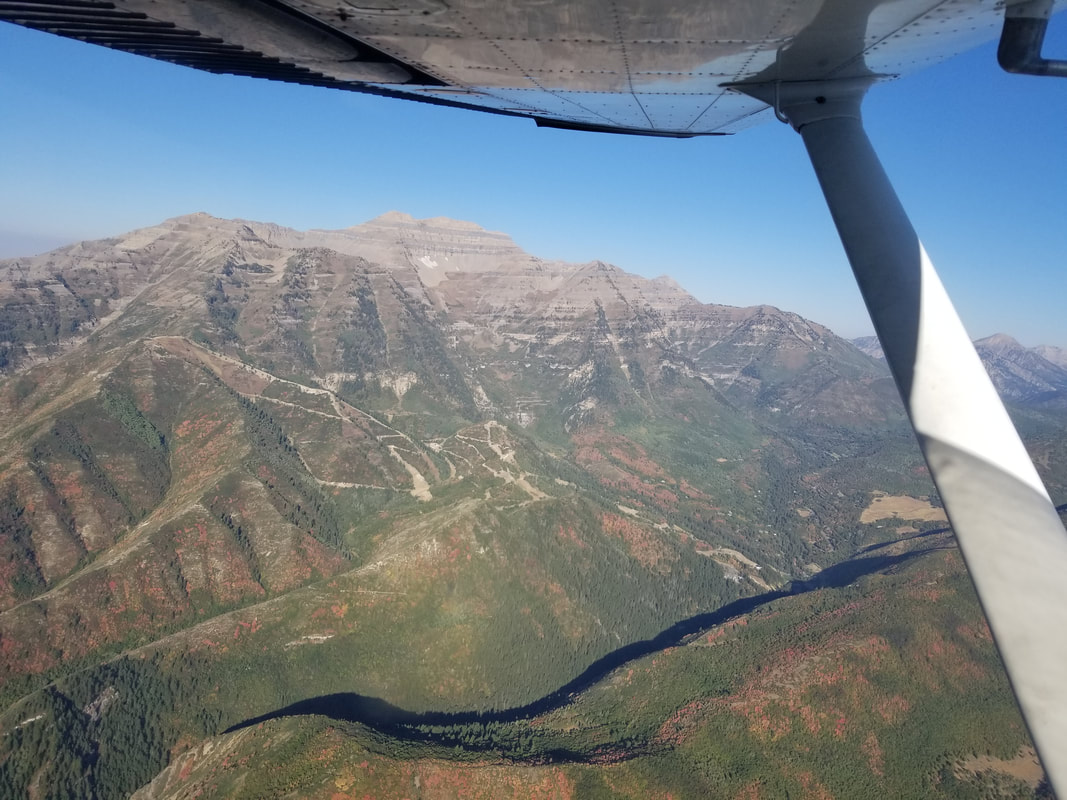
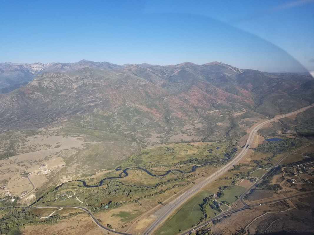
We then followed Provo Canyon, crossing the Wasatch Mountains, from about VFR checkpoint VPPVO to Heber Valley Airport (KHCR) over Deer Creek Reservoir. I chose to hug the right side of the canyon this time to enjoy views of Mount Timpanogos and have “my out” on my side of the airplane in case we encountered any troubles.
According to the locals, the leaf colors started to change early this year and I sure appreciated it. I guess not all is bad in 2020.
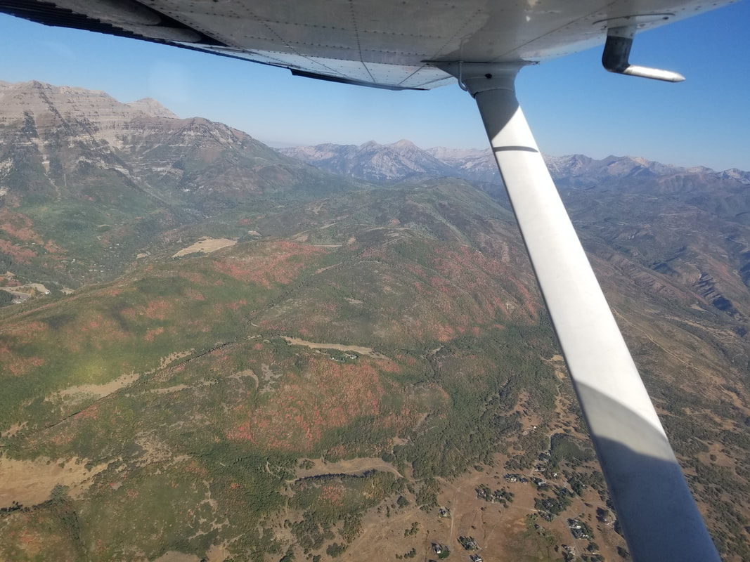
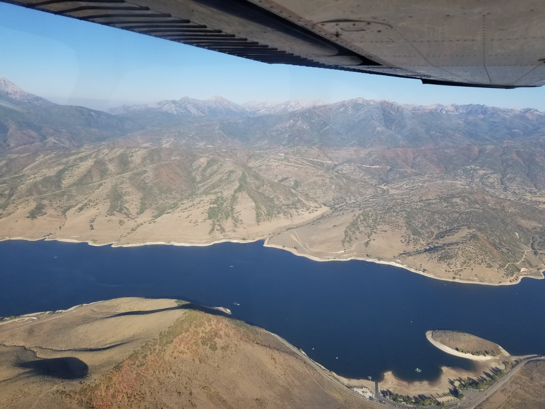
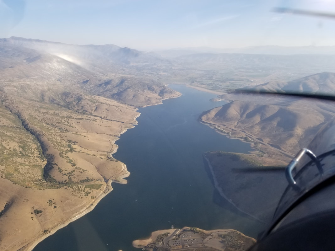
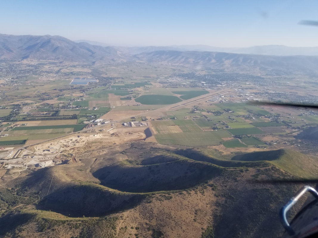
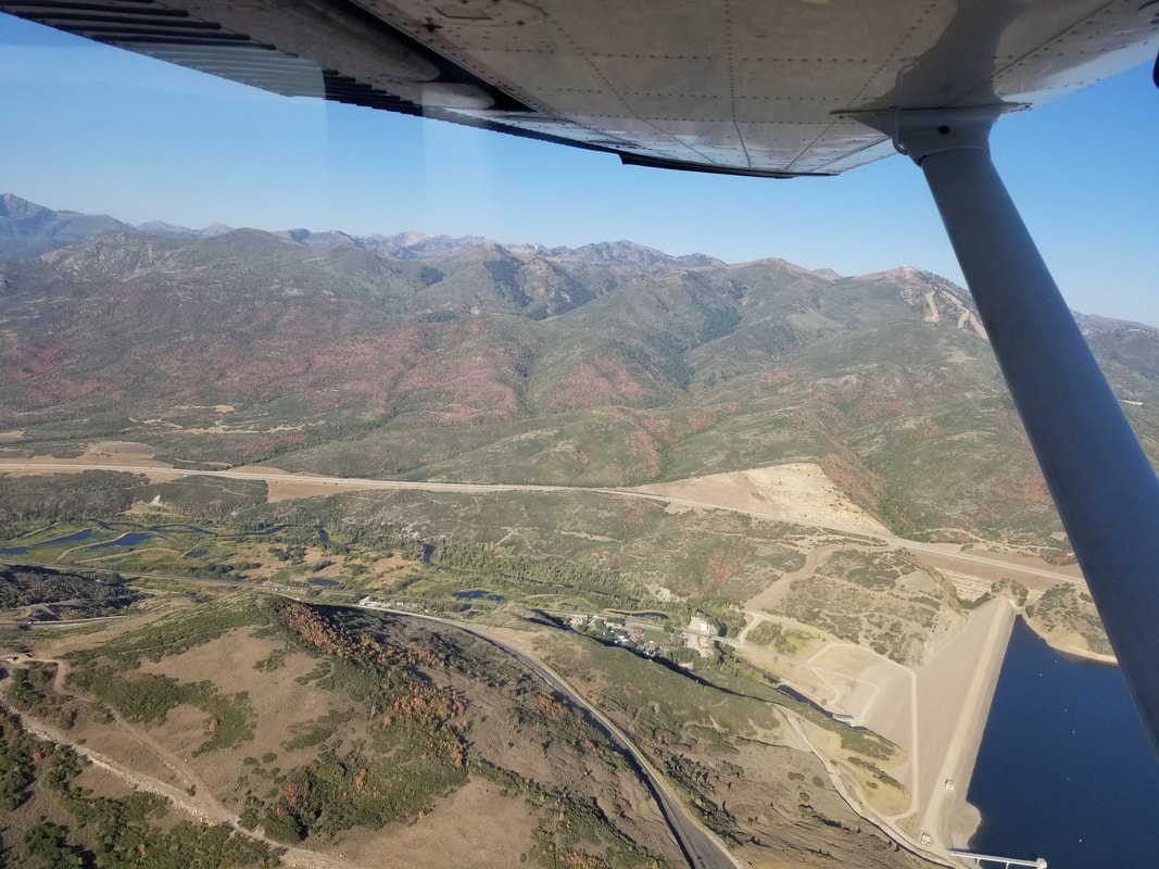
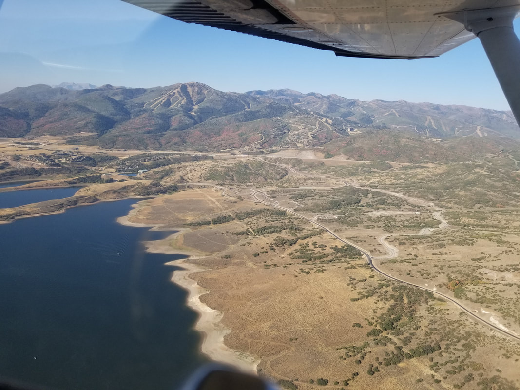
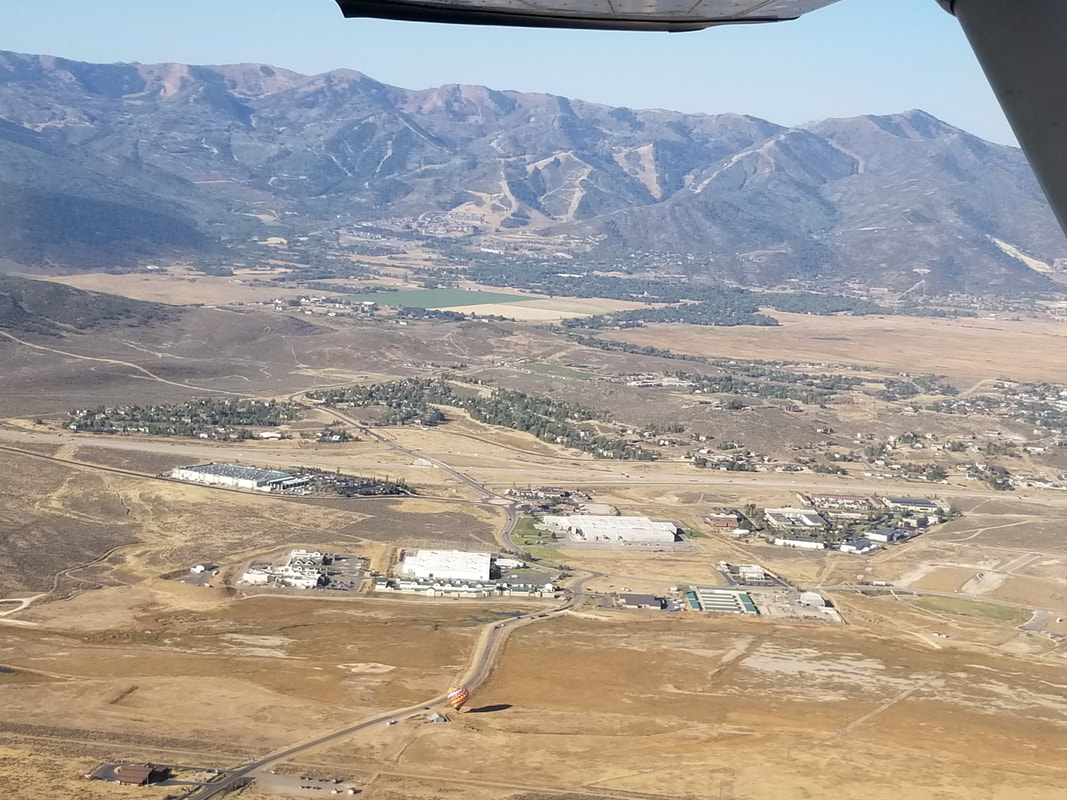
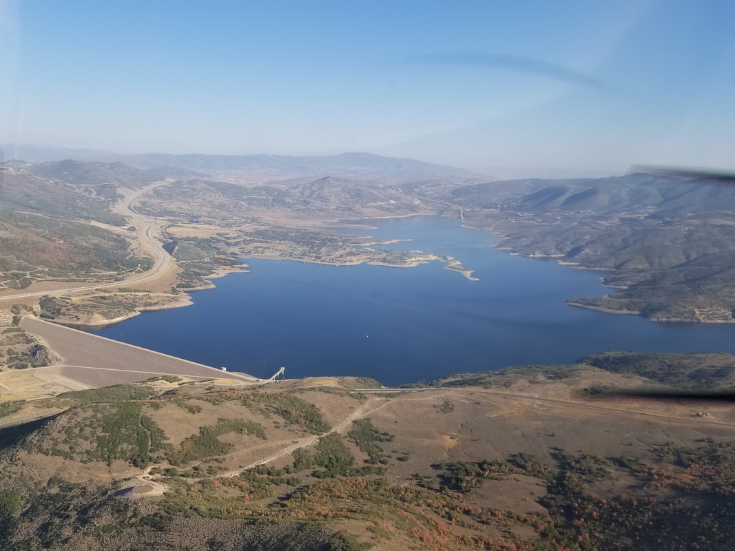
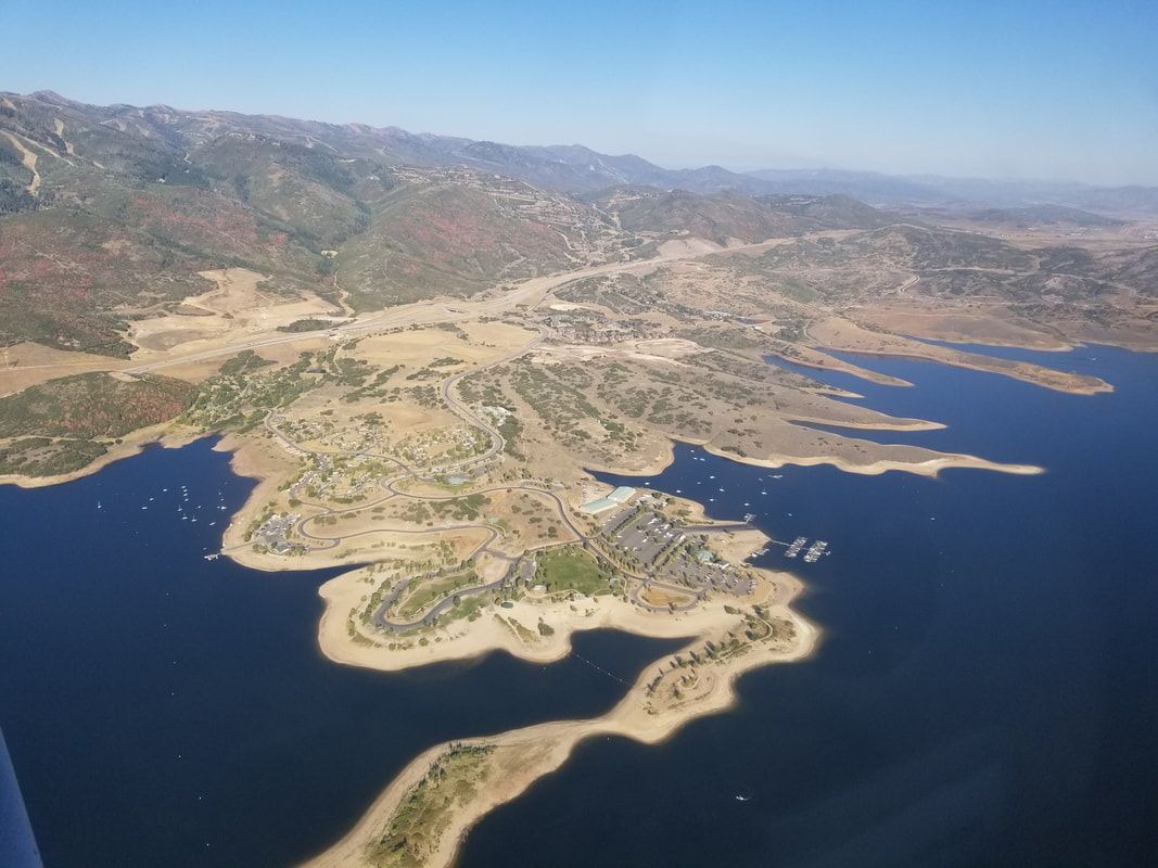
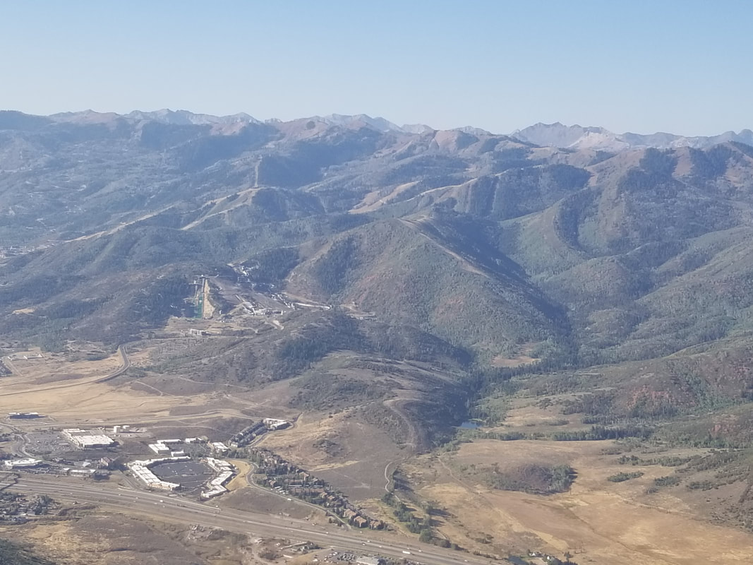
I did not land in Heber City. It did not look like a challenging airport to fly in and out of. However, it did look nice so we’ll plan on spending some time in the area with the motorhome during a future trip so we can explore Strawberry Reservoir, the Timber Lakes, and the surrounding mountains as well. 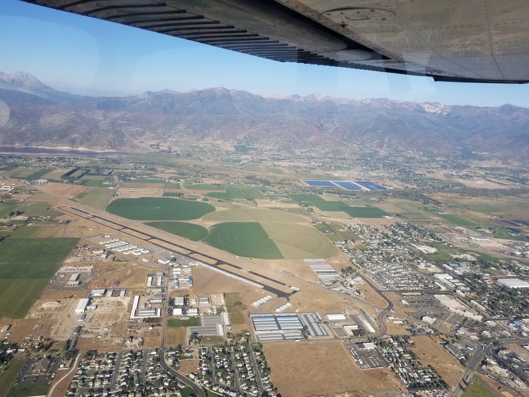 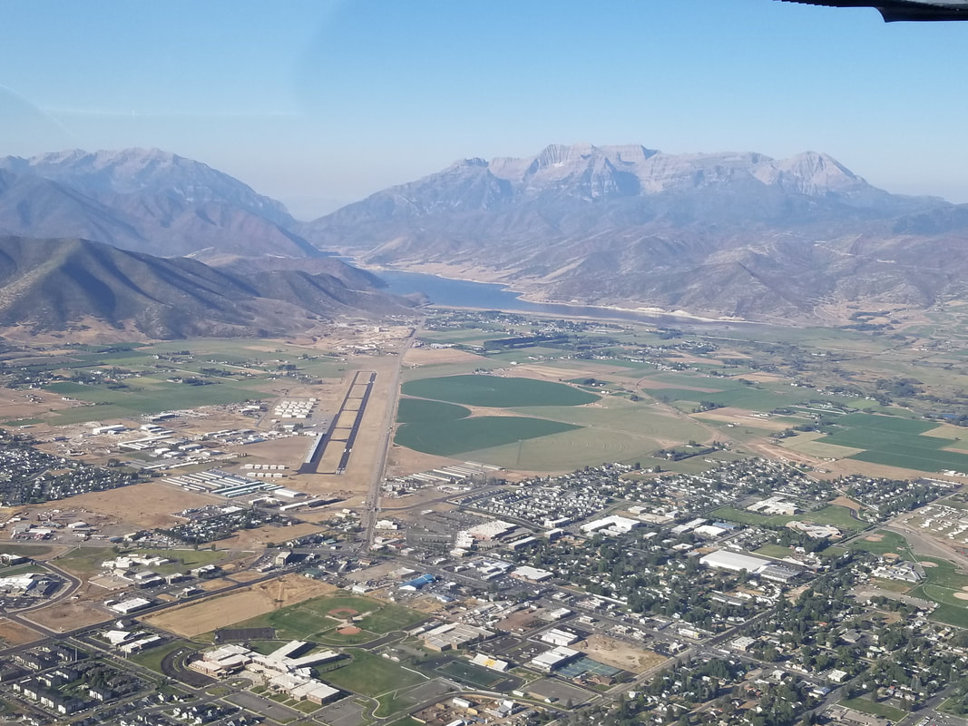 And, from Heber City, to Park City via Jordanelle Reservoir, a popular place for boaters and RVers. Of course, we got to see a few ski resorts and the Utah Olympic Park (last picture of the next set) as well.
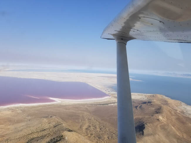
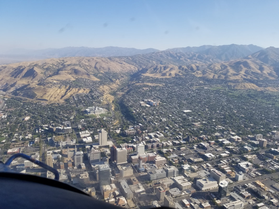
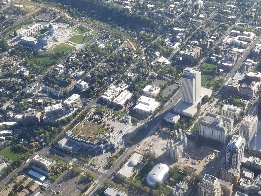
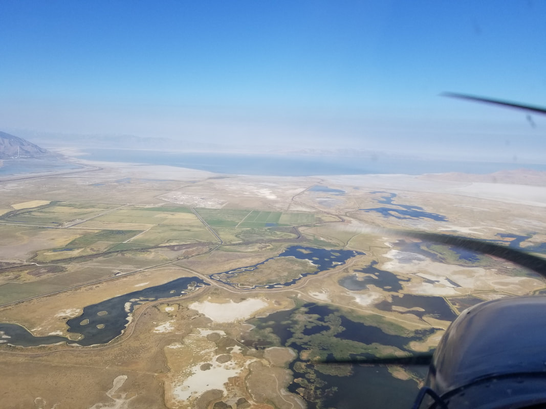
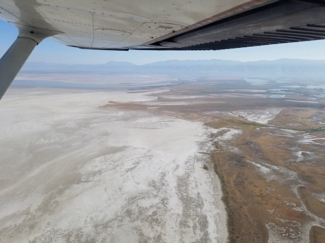
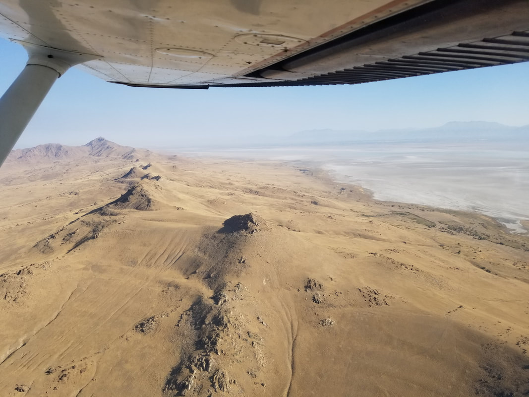
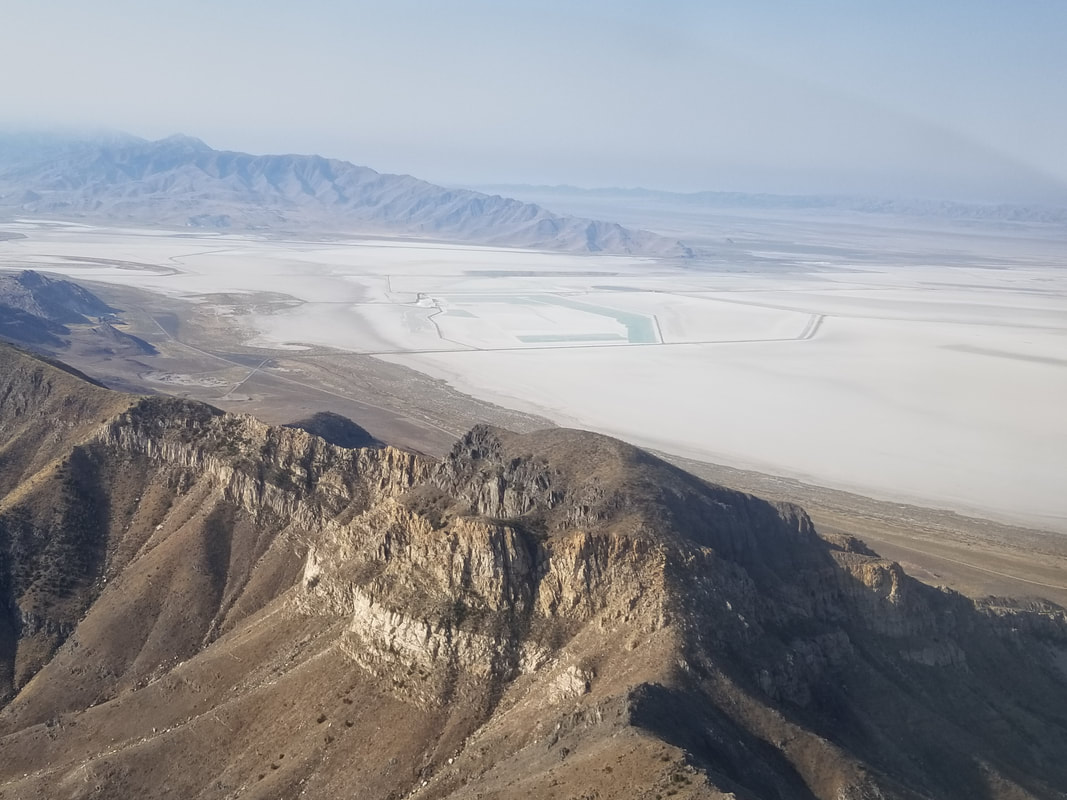
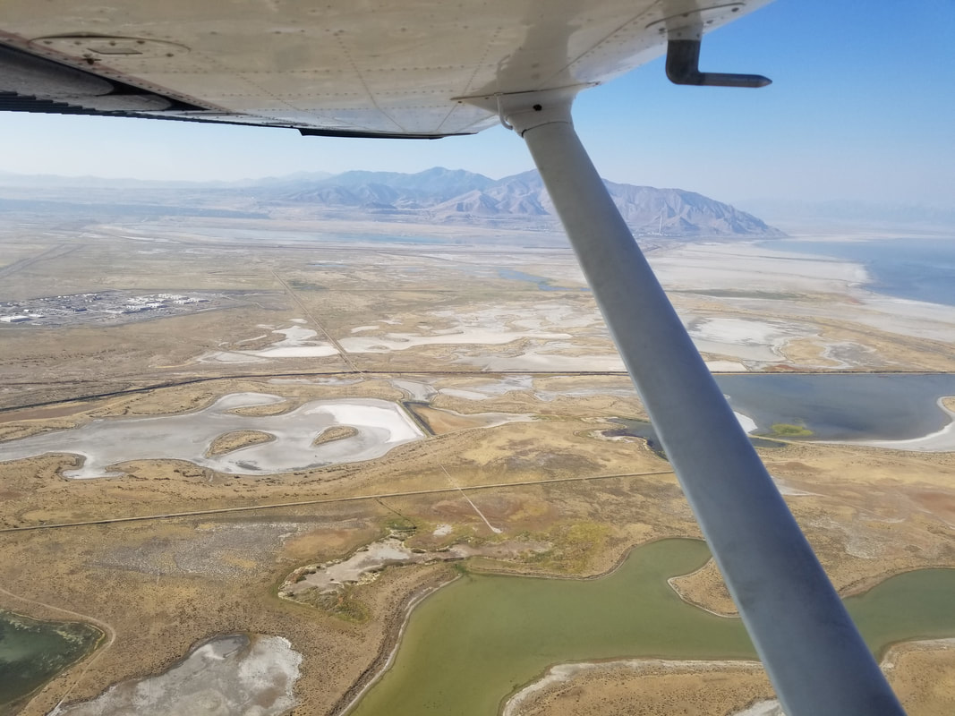
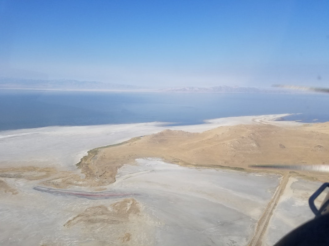
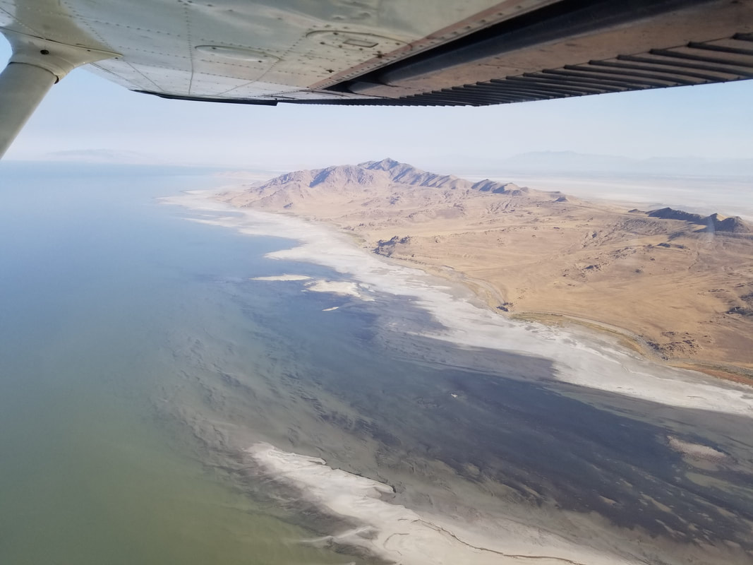
On the way back towards SLC, instead of taking Parley’s Canyon (since I’ve seen it via car multiple times and you can see it in the picture below), I took the next canyon north to see Hogle Zoo (VFR checkpoint VPZOO). 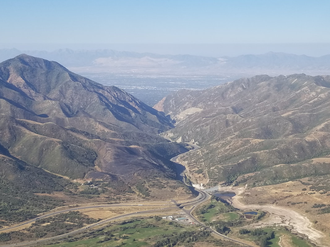 That put us right in the middle of downtown SLC and then ATC had me fly over the north end of KSLC over to Antelope Island. It’s always pretty cool to fly over big airports and see aircraft coming and going.
  Flying to Antelope and Stansbury Islands looked a bit surreal. The landscape is very unique and a bit “out of this world” looking. There’s salt, marsh, agriculture, sand, water, algae, rocks, desert, all mixed together with a variety of different colors and forming a variety of different shapes. You are also seeing some of the smoke from the California fires in these pictures as well.
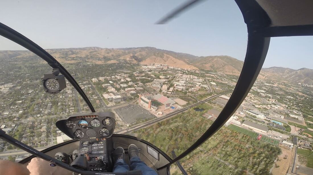
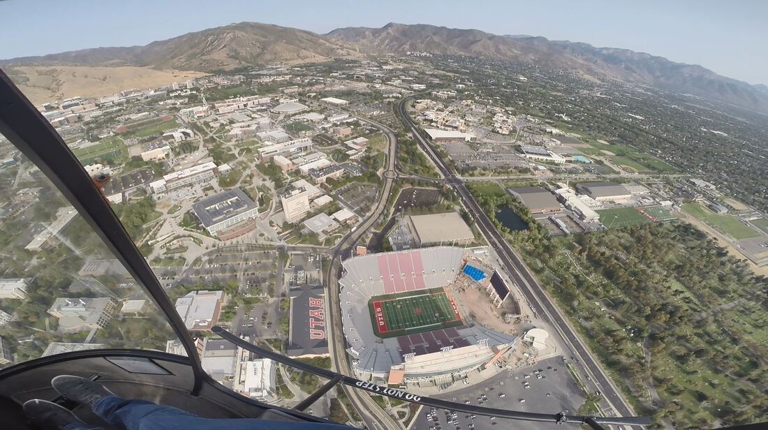
 The flight back was uneventful, with a short landing at U42. (While it may seem like I'm dragging the tail a bit, I actually had 4 white lights on the PAPI. The long empty land in front of it may create an illusion.) 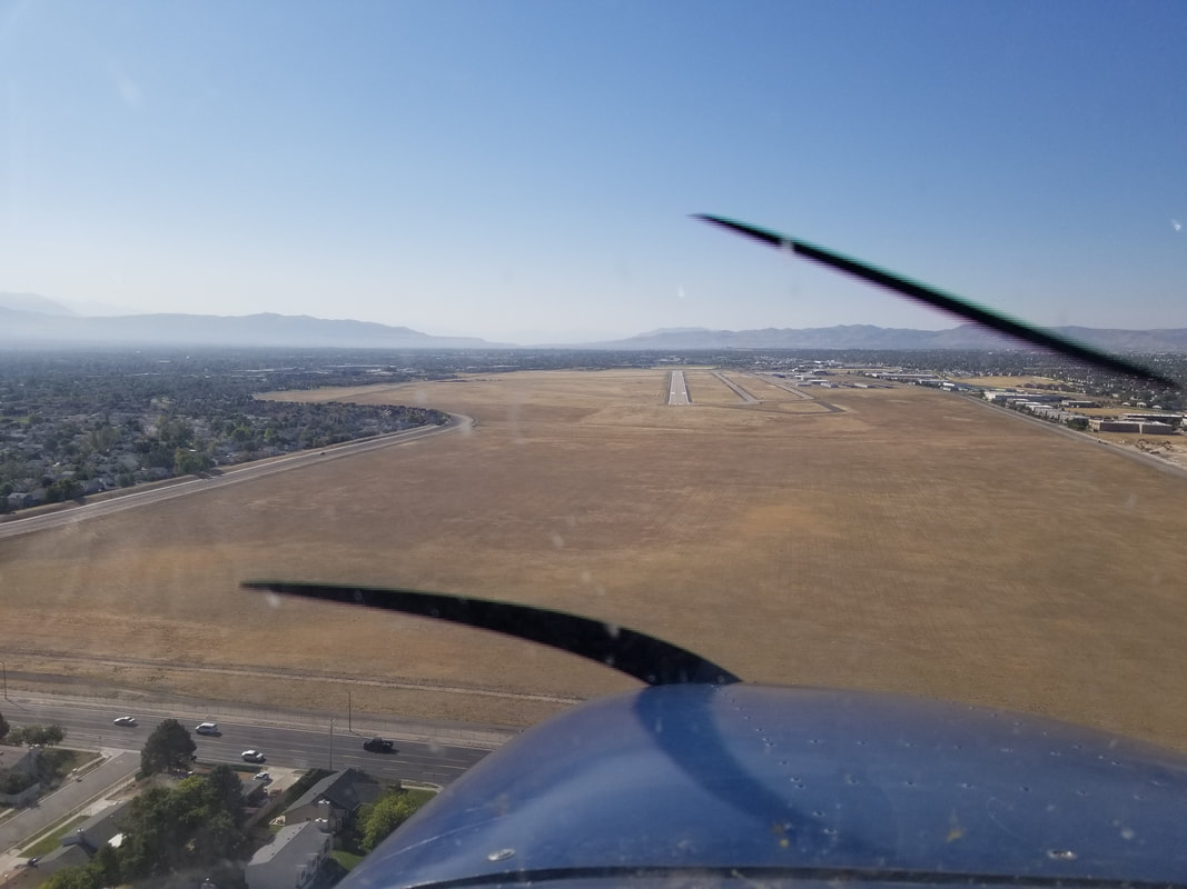 To be able to see the fall colors a bit better and because I always enjoy landing off-airport (especially in areas with terrain and elevation), the helicopter flight focused around just that. Plus, I had time to do some fun hover maneuvers once back at U42. The two flights were on different days. One of my personal minimums is: Don't fly both aircraft types on the same day! 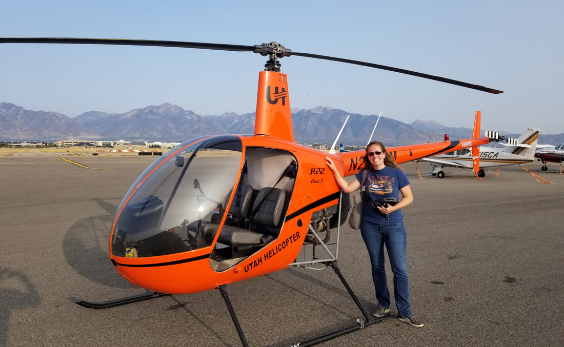 (Because it’s not safe for me to be flying “the blender” and take pictures, these pictures come from GoPro video footage. That’s the reason for the wide angle.) I first flew towards downtown SLC with the idea of flying around the University of Utah and then heading south along the foothills of the Wasatch Mountains.
Approaching the I-80 and I-215 junction leaving Parley’s Canyon on the left. 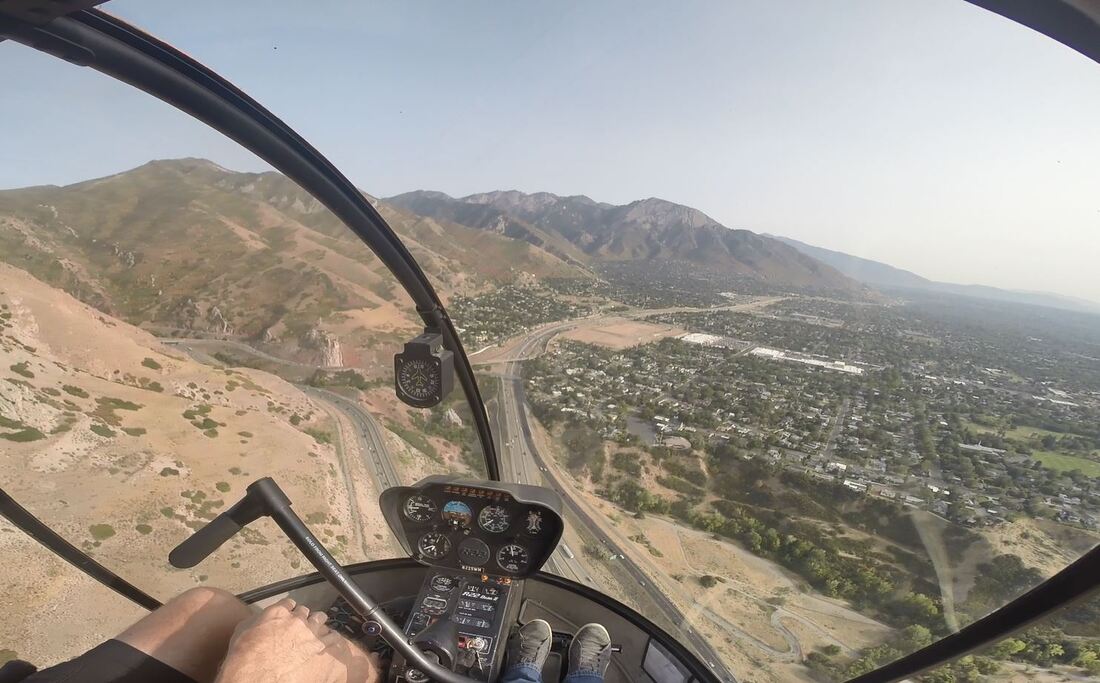 Flying down the foothills:
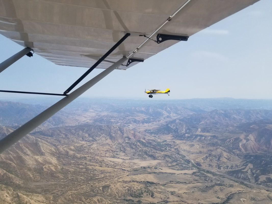
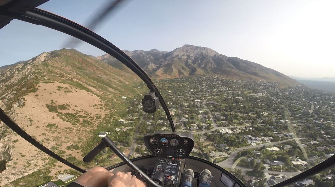
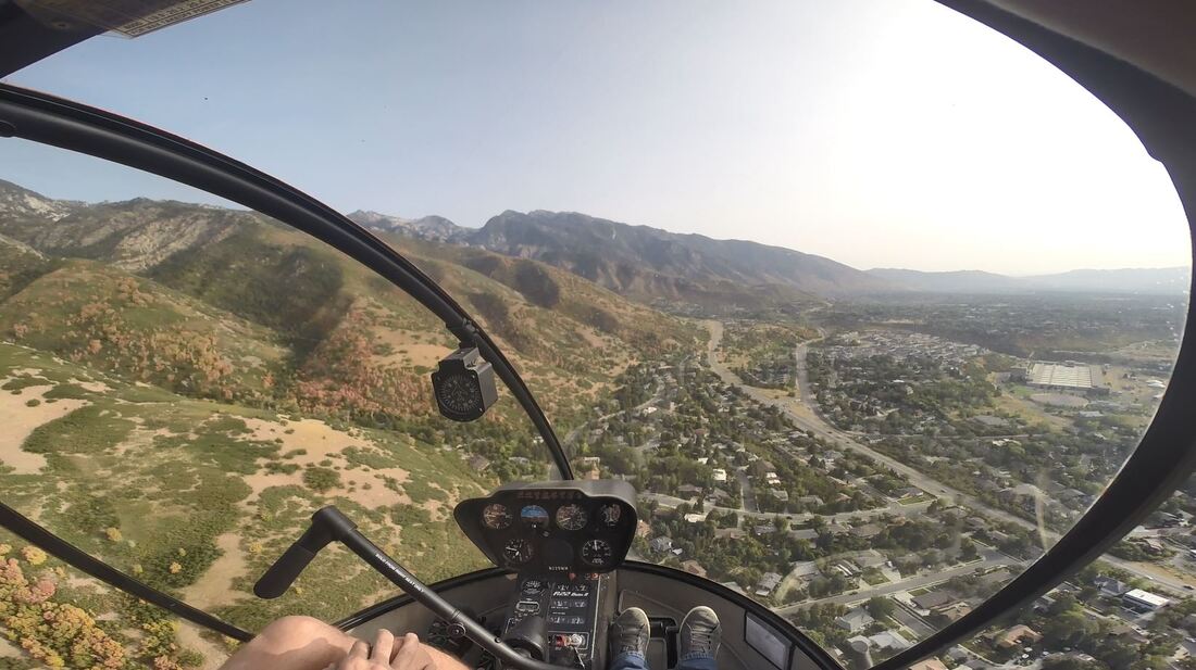 Utah Helicopter has permission to operate in and out of a private property close to one of the canyons, so we stopped in there as well. Off-airport landings are usually my highlight of heli flying and this time was no exception! 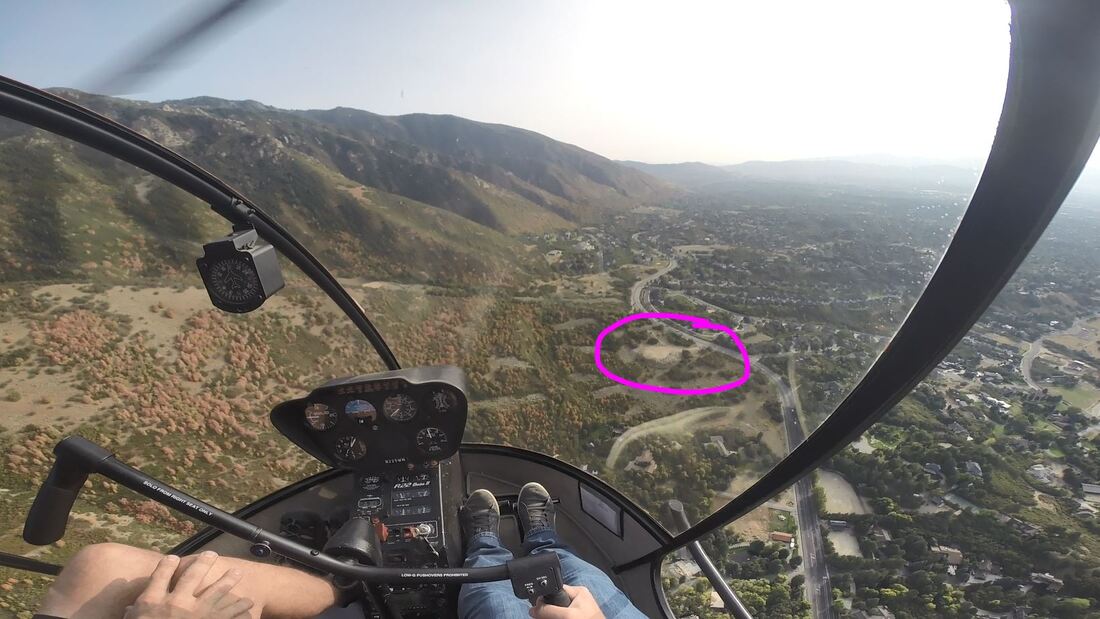 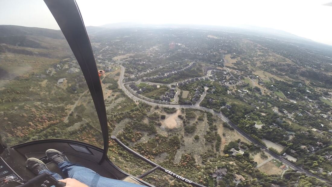 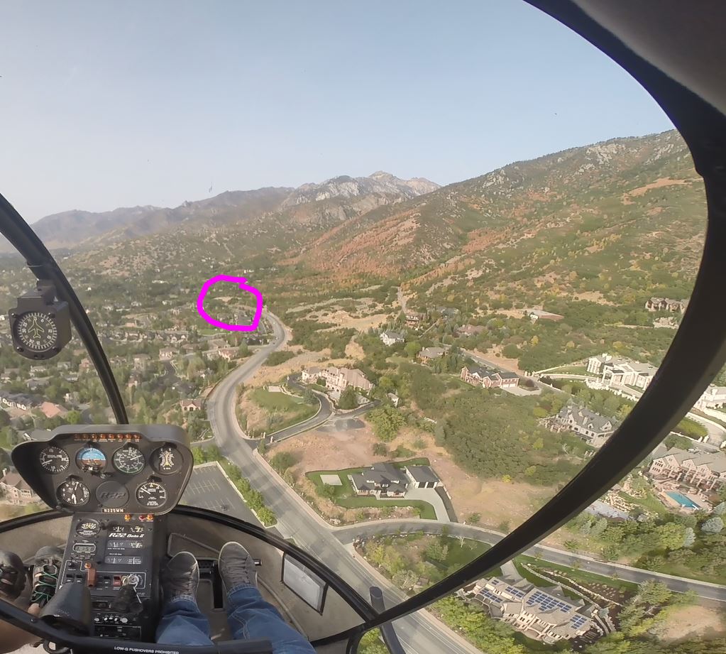 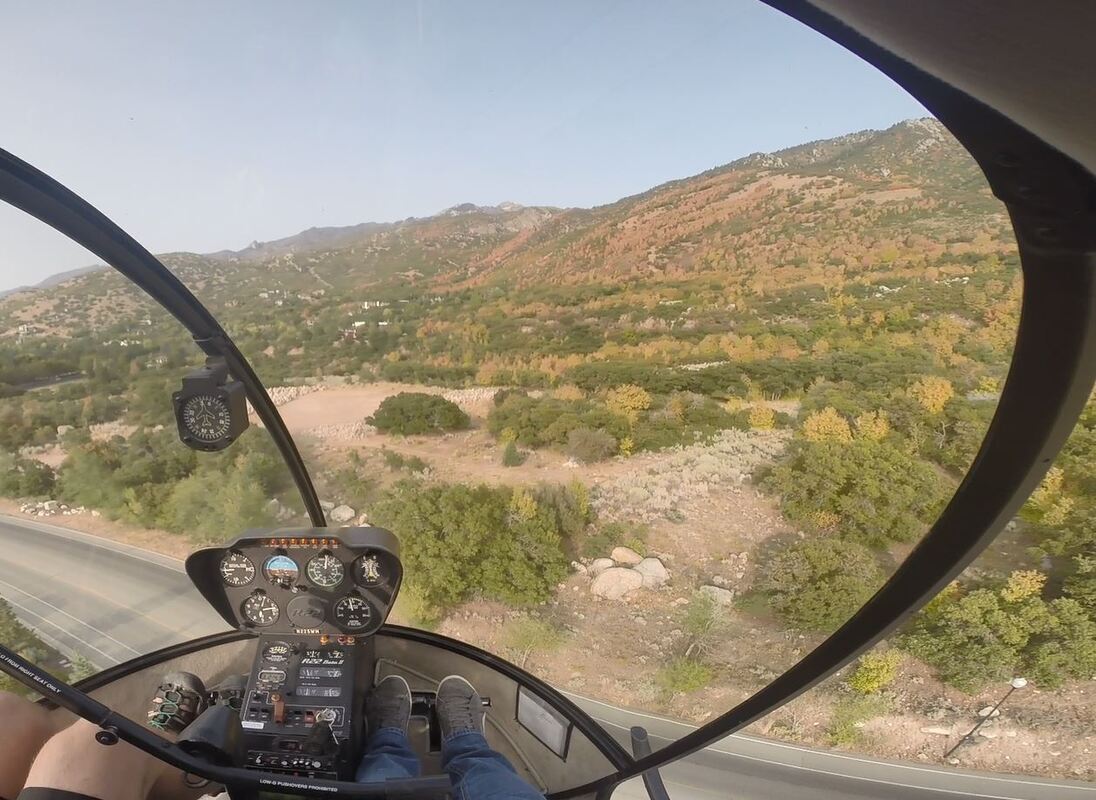 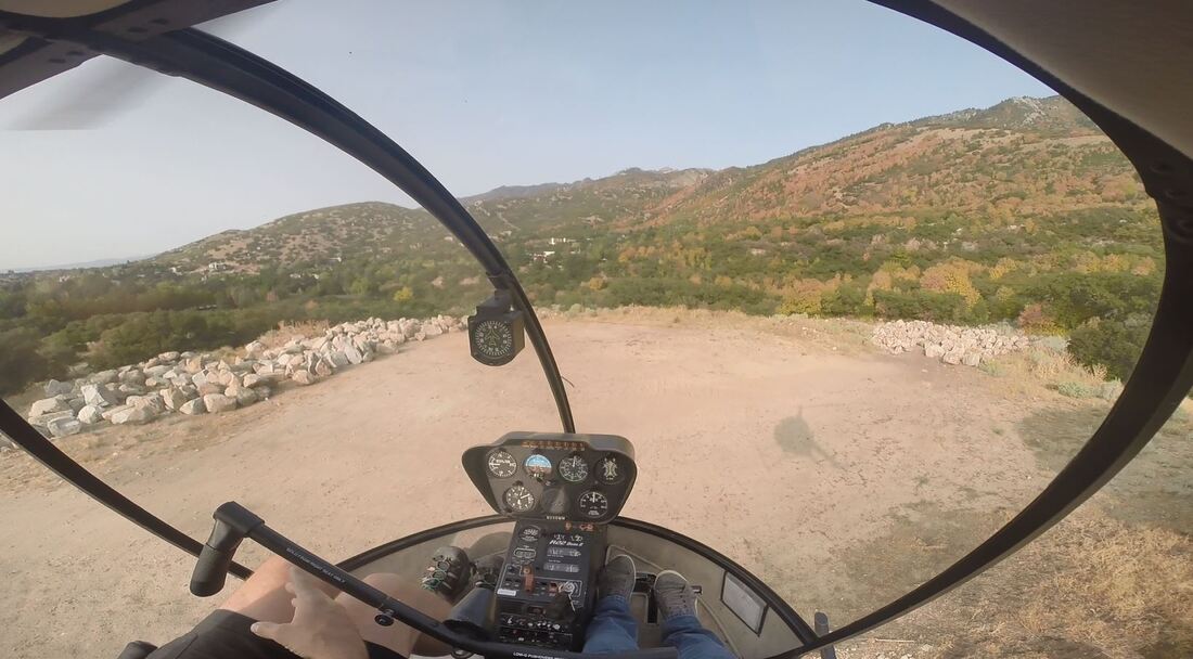 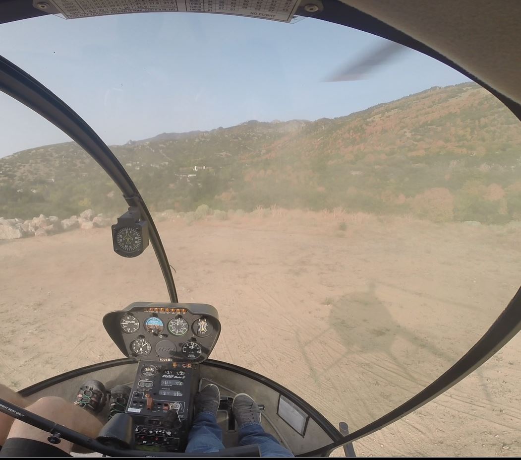 I mean, aren’t these beautiful mountains? 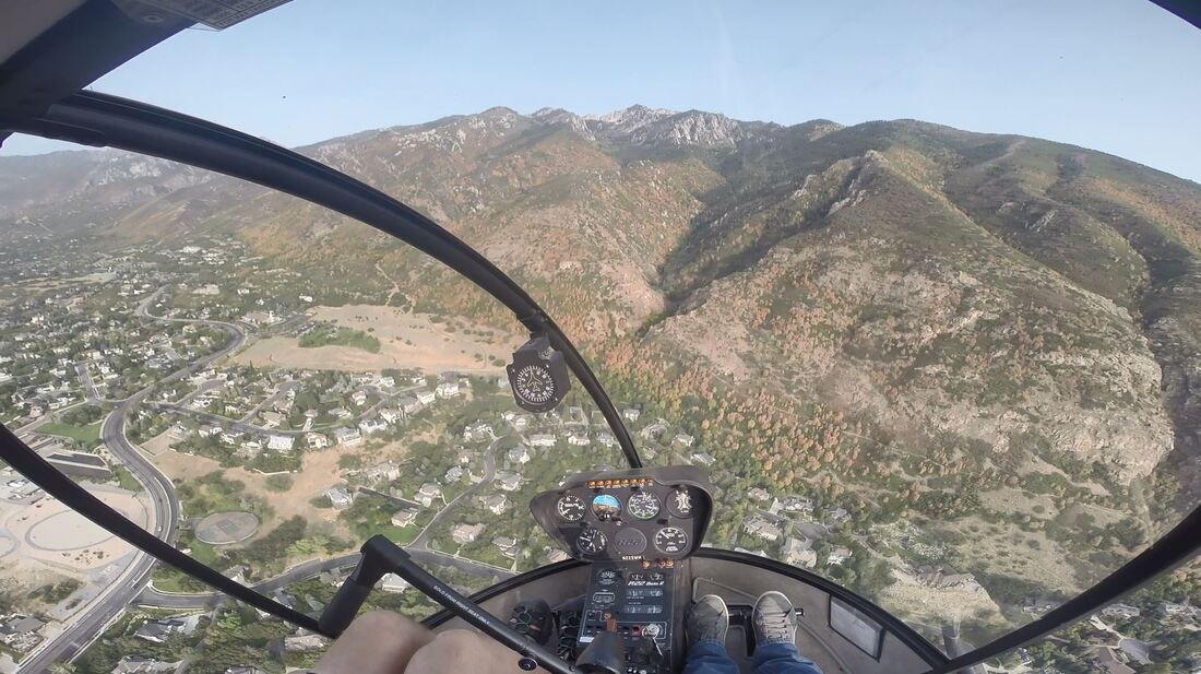 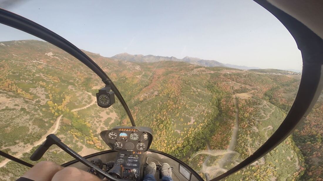 Here’s an example of some of the cool and unique things one can see from the air: 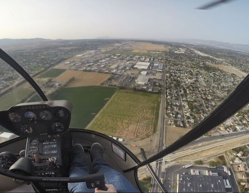 Lined up with Taxiway A: 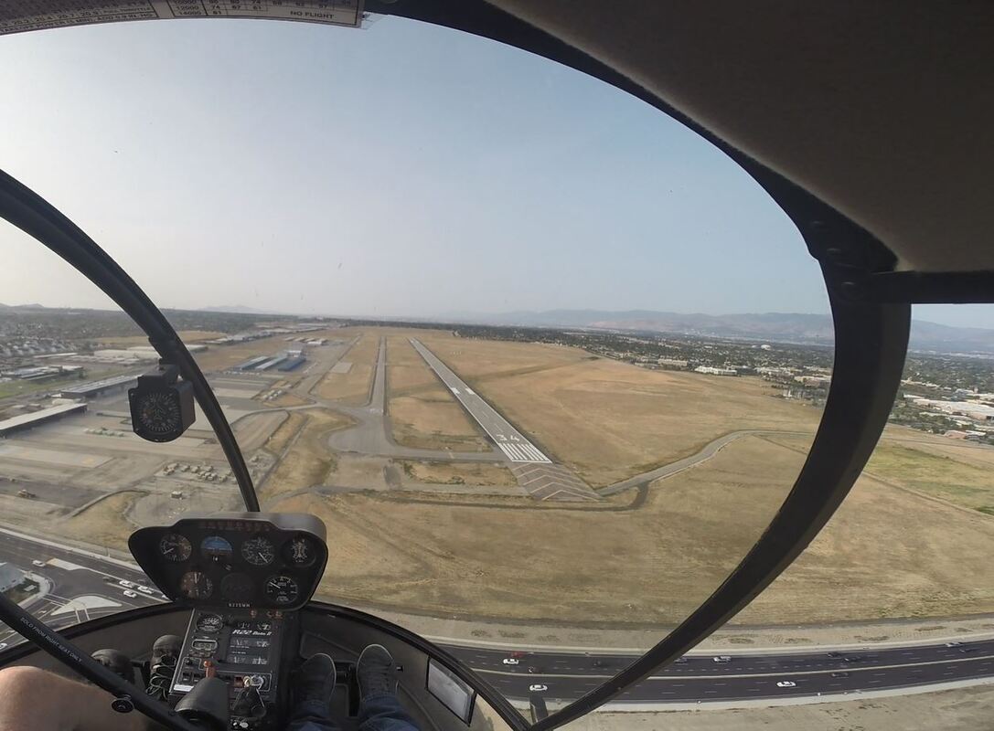 Approaching and hovering over H3: 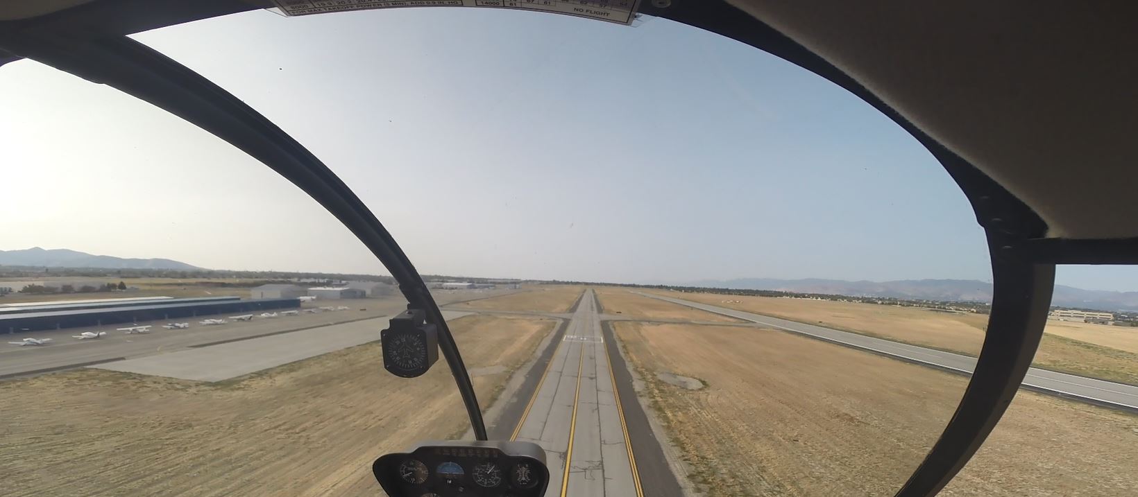 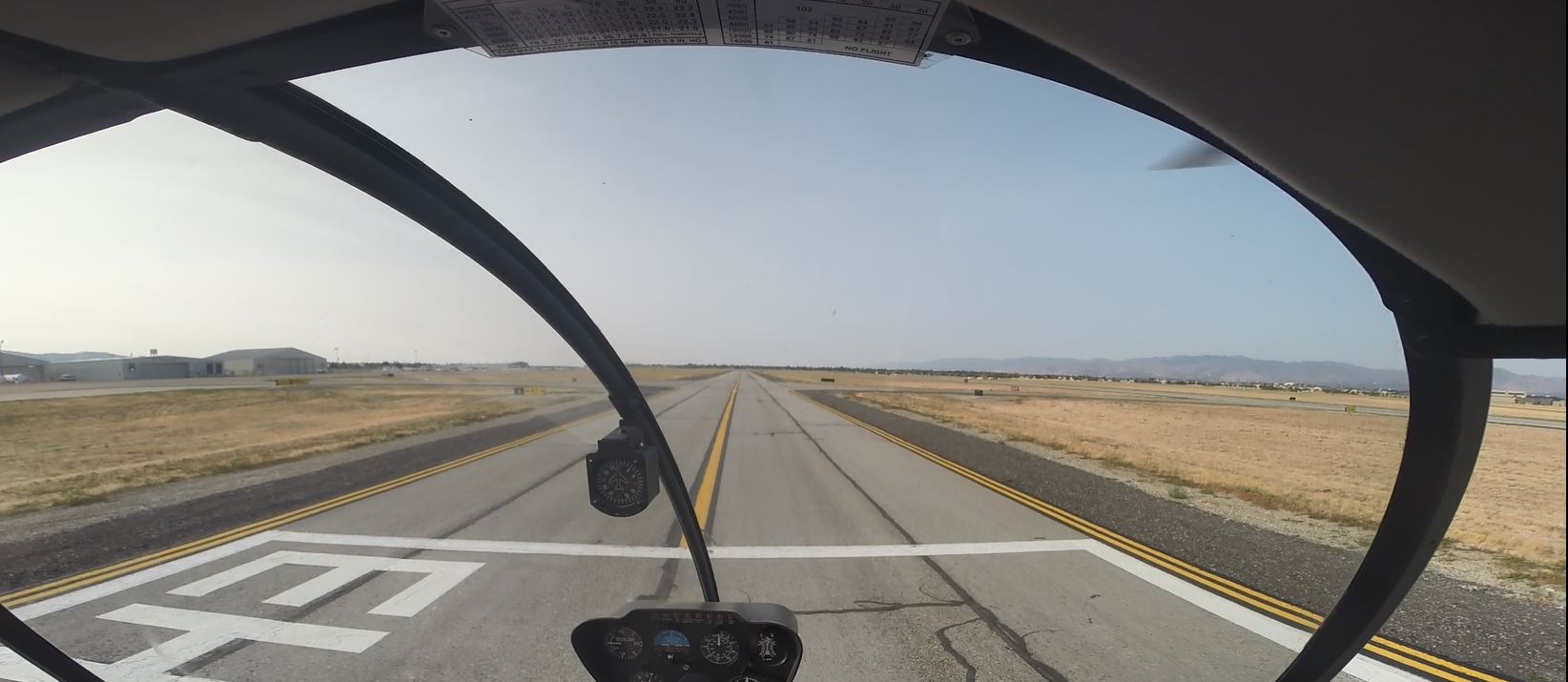 Being dual rated is the most fun one can have. Best of both worlds!
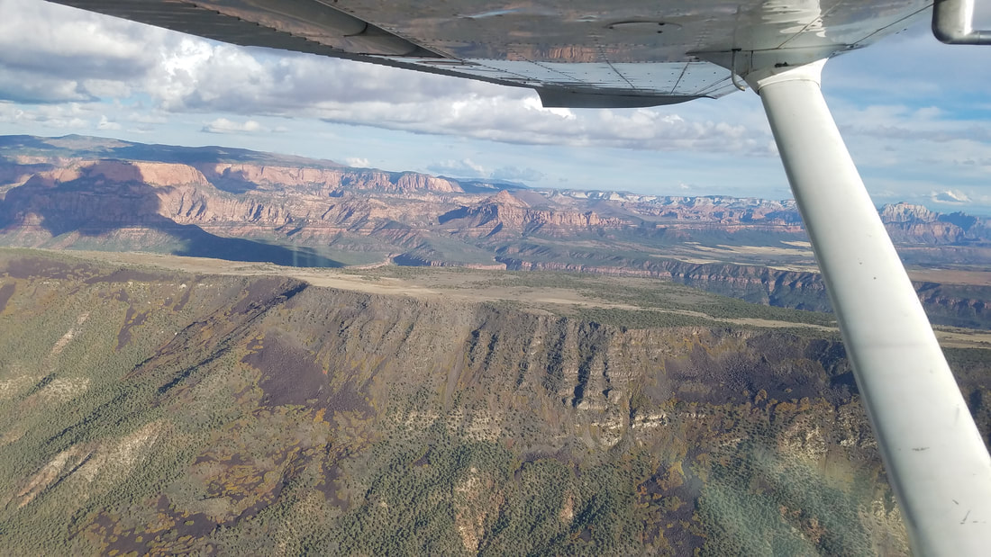
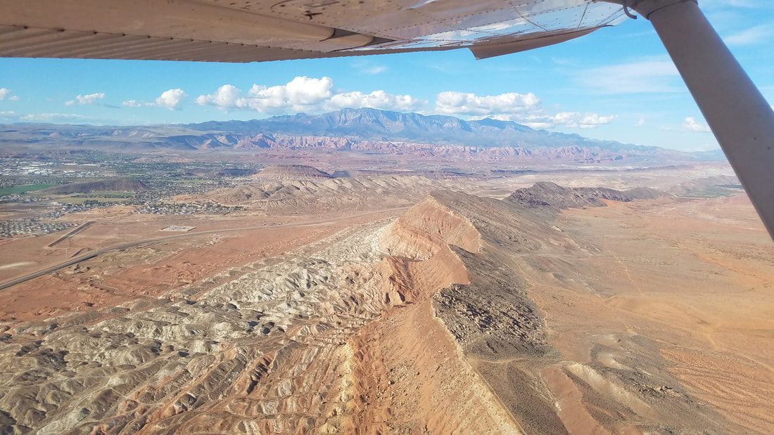
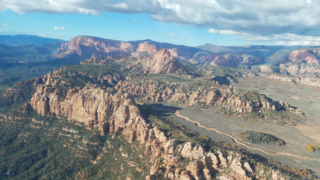
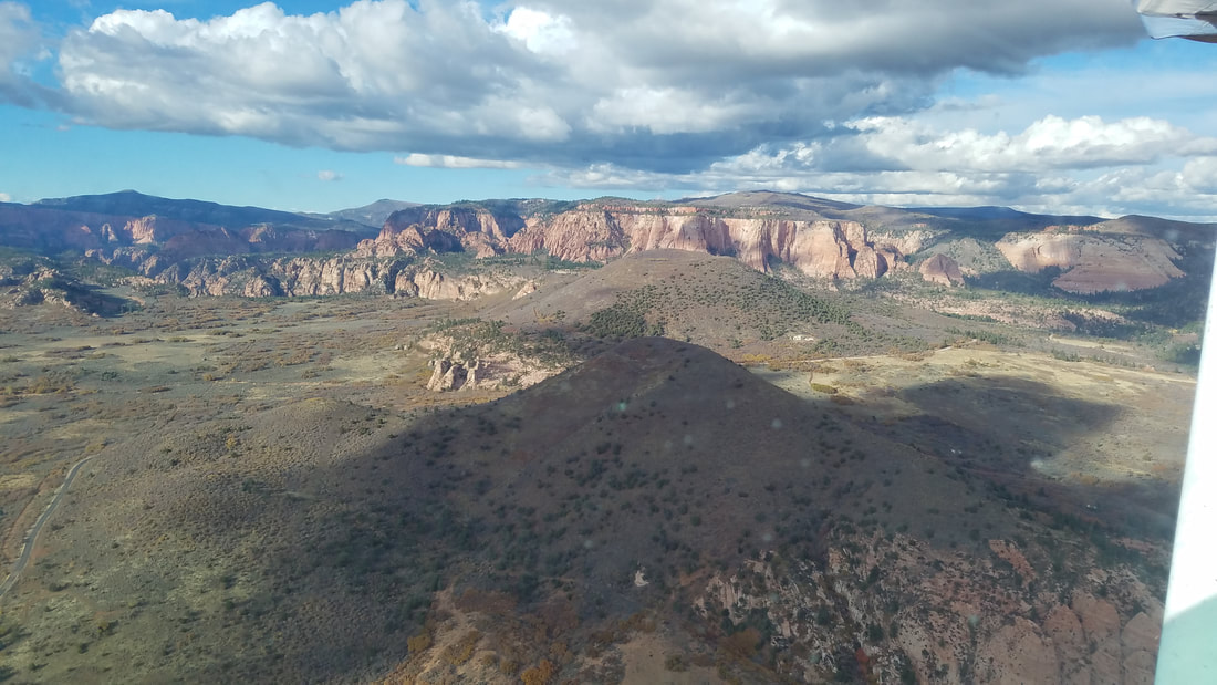
Fly safe and fly often! (This blog was originally written on Oct 24, 2018) You may have noticed that the Beehive State, Utah, is pushing a strong tourism campaign. They have good reasons to. The state has sooo much to offer; they truly have something for everybody. And I really like their tag line – Life Elevated®. Everybody likes to be elevated when the word means “exalted, joyful.” Then, some of us (including you since you are reading this blog) like to feel elevated when the word has a physical meaning: “raised up, especially above the ground or above the normal level.” So, Life Elevated® to me means a “lifted life,” a life full of happiness, excitement, traveling, adventures, flying, etc. And I like the sound of all of that. My husband and I recently visited Southern Utah as part of a wonderful trip to celebrate our 10th wedding anniversary and we can attest that "Life Elevated®" does mean all of that I mentioned. Even though this was a ground based trip where we did a lot of hiking, canyoning, camping, biking, Jeeping, etc, I couldn’t resist and had to get airborne. After calling multiple instructors, I finally found one (Joey) with Aviation Services Group at the St George Regional Airport (KSGU) who squeezed me into his schedule to get a checkout in their C-172. St George is a good hub; it’s “a stone’s throw” from all kind of places and activities but one can be in the area for weeks and not see and do everything on the bucket list. So, one good way to cover a lot of ground in a short amount of time is to fly over it all! During our 1.8 hour flight, we saw all the towns around it, several state parks, multiple wilderness areas, other important (man-made and natural) features and, of course, the majestic Zion National Park (NP). We also landed at the Mesquite (67L) airport in addition to KSGU. 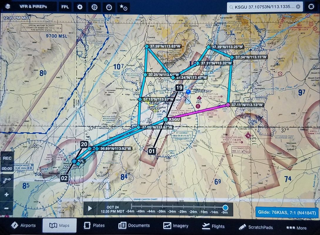 This is the approximate track we flew Source: ForeFlight A previous blog I wrote, Flying to National Parks (https://airtrails.weebly.com/other/flying-to-national-parks), shares with good tips for things to consider when flying over and around federal, protected land. The most basic is… fly at least 2,000 feet over as suggested by Advisory Circular 91-36D, VFR Flight Near Noise-Sensitive Areas (https://www.faa.gov/documentLibrary/media/Advisory_Circular/AC_91-36D.pdf).
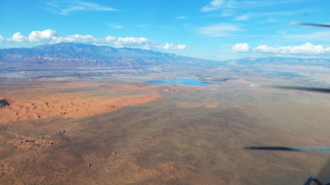
Soon after departing KSGU, we could see Sand Hollow State Park (the area with the orange sand and lake on the second picture), a favorite for us to go Jeeping. 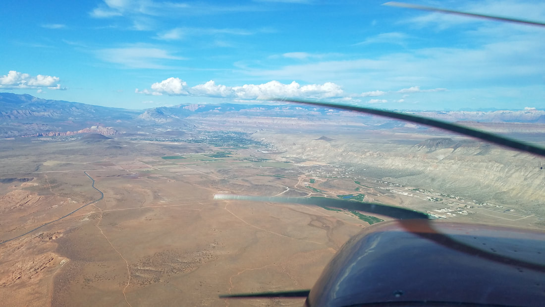 Can you spot private airstrip community Grassy Meadows/Sky Ranch (UT47) and Stout Airport (1L8) in Hurricane? We did not land at either but Joey told me Stout is a bit sporty with their higher elevation and shorter runway that has a higher middle section, making it impossible for pilots on one side of the runway to see the opposite end.
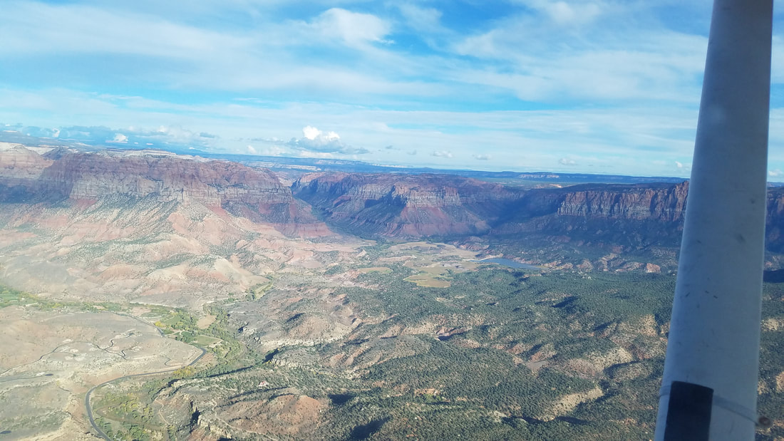
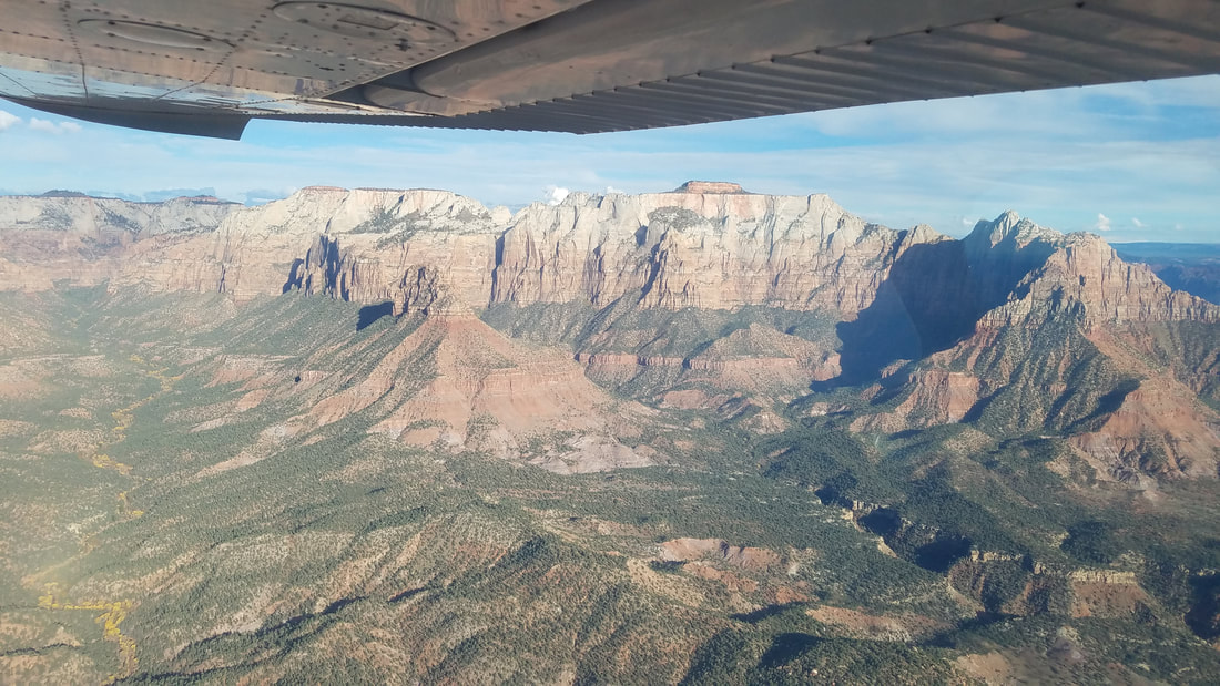
That road you see in both of these pictures is Highway 9, the Zion to Mt Carmel Highway 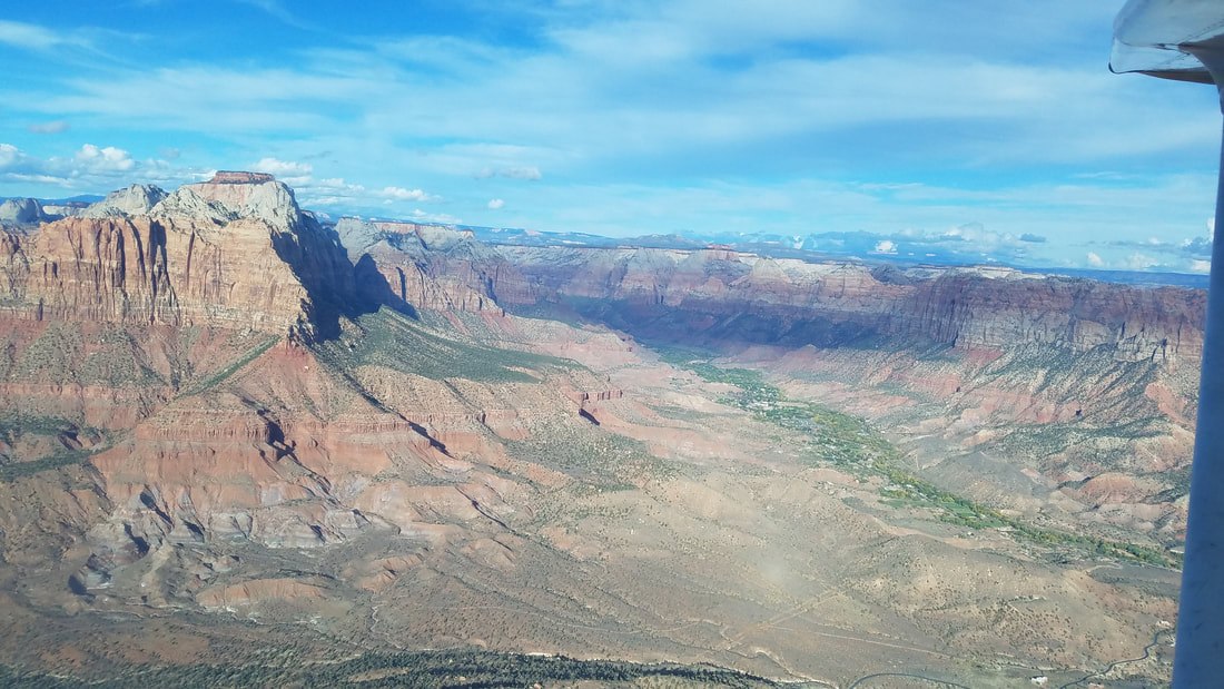 The beautiful town of Springdale in the green area with Zion surrounding it
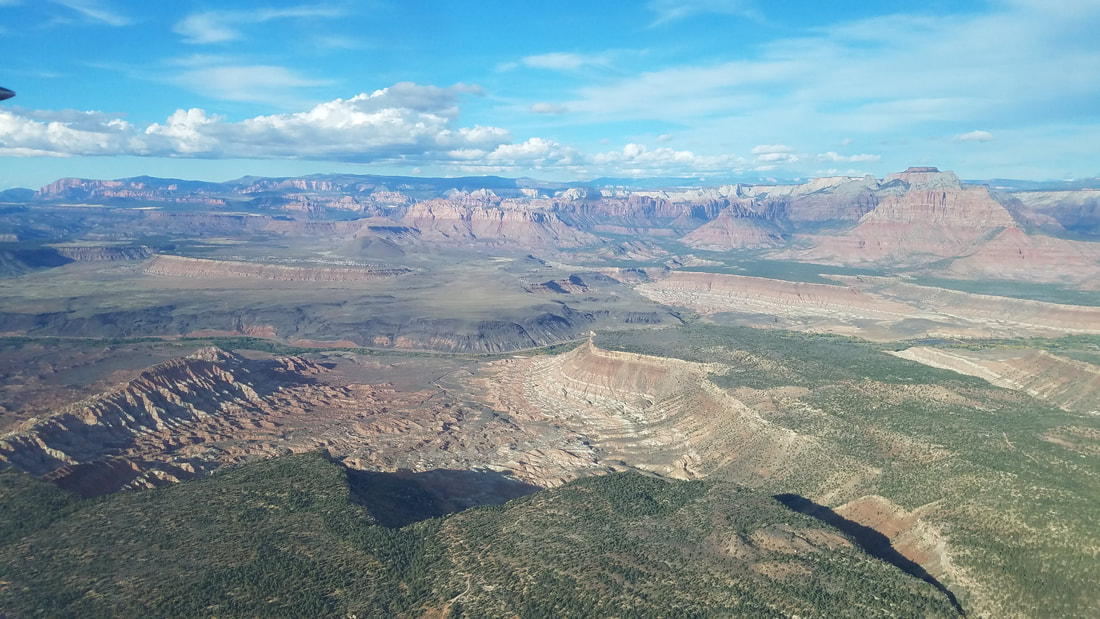
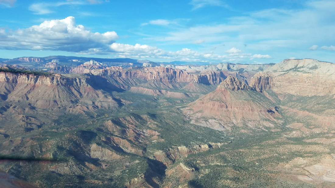
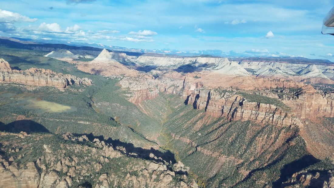
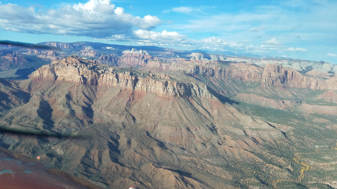
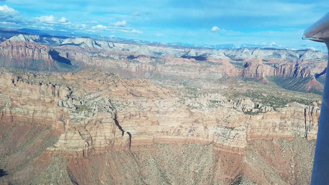
 All pictures of Zion (and little bit beyond) because, well, I just couldn't get enough of its beauty. The second to last picture almost looks like Bryce Canyon NP instead. 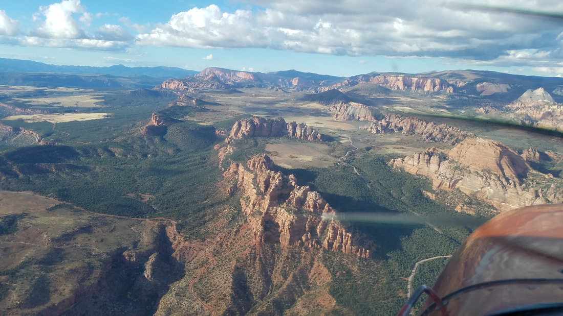 The second "pile" of canyons/rock structures is Lambs Knoll, a great area for climbing and canyoneering/canyoning (of which we took great advantage of). While it is not technically in NP land, it is in Bureau of Land Management (BLM) land, on Kolob Road.
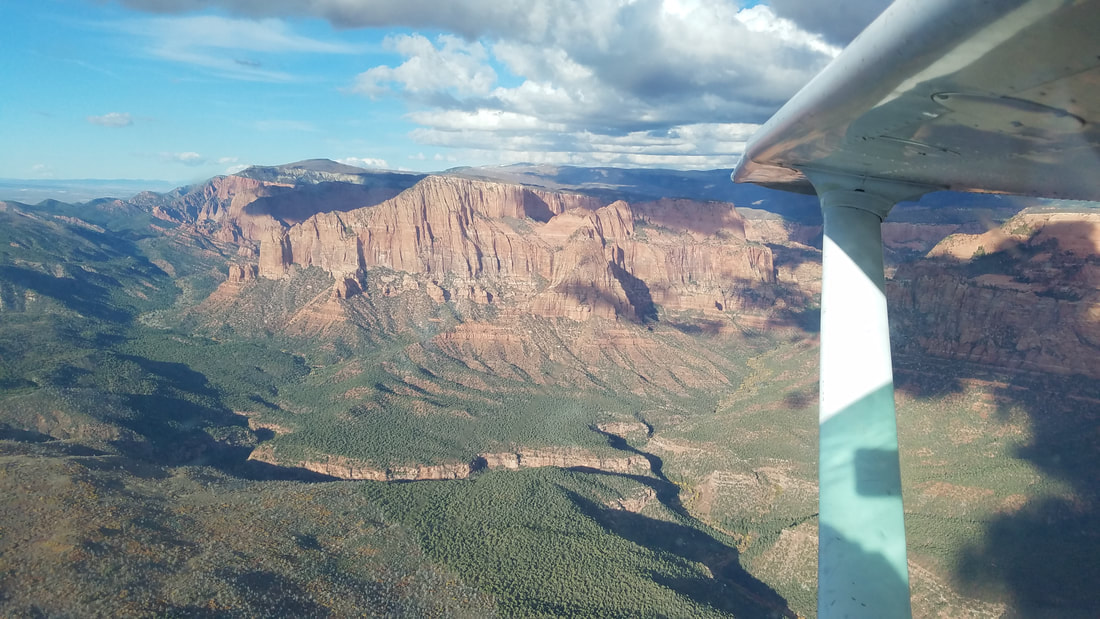
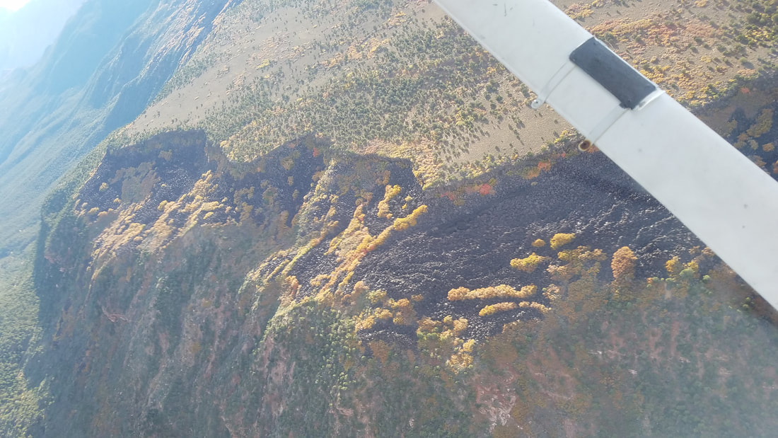
 Believe or not, those two "bumps" on the first picture are volcanoes. Thankfully, they are either dormant or extinct volcanoes. However, you can see dried up lava on the second and third pictures from the time when it was active. It is pretty impressive to see the lava amongst the rest of the landscape, especially with the pretty fall colors. 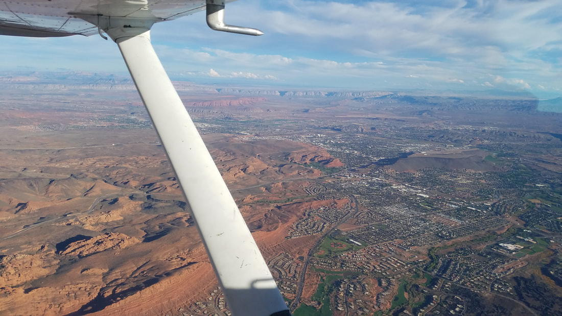 Here is a picture of St George as we were flying by Snow Canyon State Park. Unfortunately, we could not see much of this state park because the combination of the sunset and the terrain to the west kept the park mostly in the shade, making it hard to see. You may also spot two airports in this picture. Well, the first one (in a mesa) is the old, now closed airport. The one further out is KSGU. One has to be careful (and trust the instruments) when looking for the arrival airport to ensure a successful landing at the right airport. 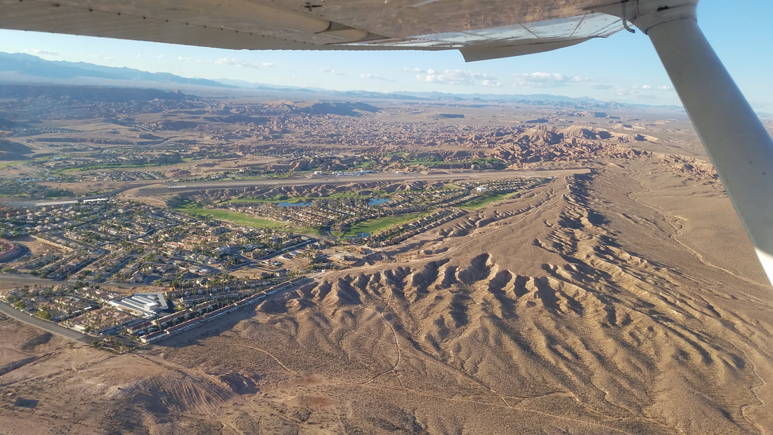 This is the gorgeous Mesquite (67L) airport, across the border in Nevada. The instructor wanted us to come here because it was a challenging airport but I did not find the challenge, just its beauty. 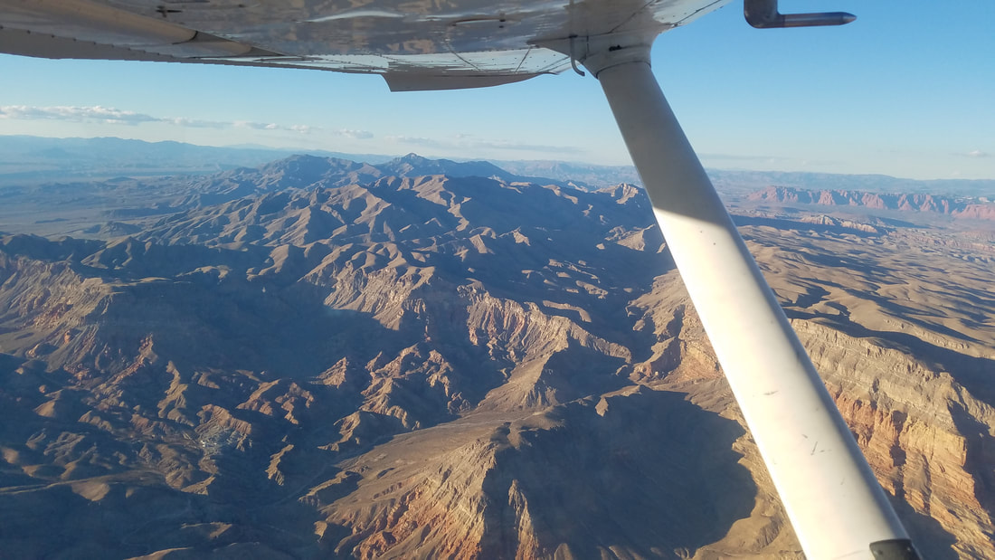 Now with the sun behind us, the sunset showcased some beautiful mountains on our return flight from Mesquite to St George  Here is another look at the town of St George (and its surrounding neighbors) and the old airport 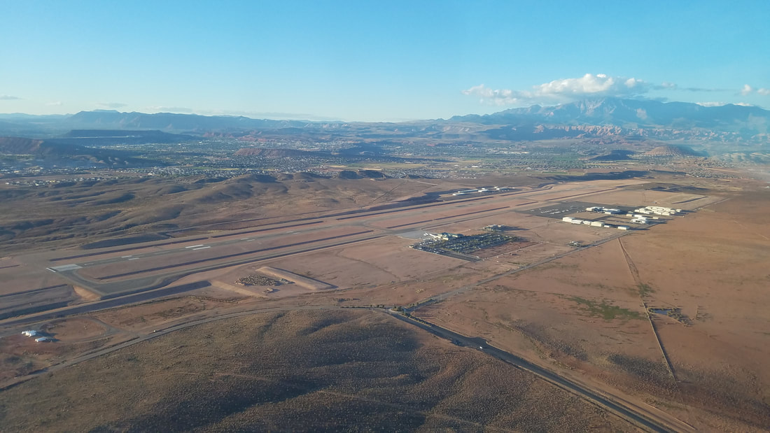 Turning left downwind for Runway 19, back at KSGU While at KSGU, one can visit the Western Sky Aviation Warbird Museum (http://www.westernskywarbirds.org/) as well, open Wednesday through Saturday, from 10 am to 4 pm.
Visit multiple airports and aviation museums in Utah, participate in the "Fly Utah" challenge, and earn prices (decals, hats, patches, and even a flight jacket!). Learn more at https://www.udot.utah.gov/main/f?p=100:pg:0:::1:T,V:5115. So, there, elevate your life, visit Utah! The tourism website, www.visitutah.com, has fantastic resources for non-flying related things. |
BLOGS ON THIS PAGE
- Experience Moab 360
- Richfield - One of the Best Places to Paraglide in Utah - Be-Utah-Ful! Backcountry Flying in Utah - Different Aircraft for Different Missions, SLC Style - Life Elevated® - Not Just Utah's Tourism Tag Line AuthorYasmina Platt ArchivesCategories |

 RSS Feed
